Area Overview for SA40 9RN
Photos of SA40 9RN
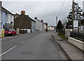
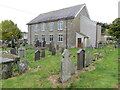
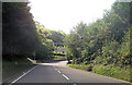
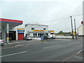
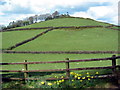
6 photos from this area
Area Information
Key information about the SA40 9RN including its size, population, and administrative classification.
- Area Type
- Postcode
- Area Size
- 6.1 hectares
- Population
- 1182
- Population Density
- 221 people/km²
House Prices in SA40 9RN
33
Properties
£113,750
Average Sold Price
£50,000
Lowest Price
£225,000
Highest Price
Showing 33 properties
| Address | Type | Beds | Baths | Last Sale Price | Last Sale Date | |
|---|---|---|---|---|---|---|
| Penybont Cottage, Llanybydder To Ty Mawr, Llanybydder, SA40 9RN | Semi-detached | 3 | 2 | £185,000 | Dec 2024 | |
| Greenacres, Llanybydder To Ty Mawr, Llanybydder, SA40 9RN | Bungalow | - | - | £225,000 | Mar 2022 | |
| Rhydafon, Llanybydder To Ty Mawr, Llanybydder, SA40 9RN | house | - | - | £61,000 | Sep 2021 | |
| Greenfield, Llanybydder To Ty Mawr, Llanybydder, SA40 9RN | house | - | - | £75,000 | Mar 2021 | |
| Werna, Llanybydder To Ty Mawr, Llanybydder, SA40 9RN | Terraced | 3 | - | £104,000 | Nov 2019 | |
| Nanteos, Llanybydder To Ty Mawr, Llanybydder, SA40 9RN | Bungalow | 3 | 1 | £184,000 | Aug 2018 | |
| Einon View, Llanybydder To Ty Mawr, Llanybydder, SA40 9RN | house | 3 | 1 | £67,000 | Apr 2015 | |
| Brynafon, Llanybydder To Ty Mawr, Llanybydder, SA40 9RN | Cottage | 3 | - | £69,000 | Dec 2014 | |
| Arfron, Llanybydder To Ty Mawr, Llanybydder, SA40 9RN | Bungalow | 3 | 1 | £105,000 | May 2014 | |
| Gwynfrais, Llanybydder To Ty Mawr, Llanybydder, SA40 9RN | Bungalow | 2 | 1 | £50,000 | Dec 2013 |
Page 1 of 4
Energy Efficiency in SA40 9RN
Amenities
Schools
| Rank | School | Type | Entry gender | Ages |
|---|
Explore more schools in this area
Go to Schools tabDemographics
Household Size
Two person
most common
Accommodation Type
Houses
most common
Tenure
59
majority
Ethnic Group
White
most common
Religion
N/A
most common
Household Composition
N/A
most common
Age
47
median
Adults (30-64 years)
most common
Household Deprivation
N/A
with no deprivation
NS-SEC
19
in Lower managerial occupations
Explore more demographic insights in this area
Go to Demographics tabPlanning
Planning Constraints
- Flood RiskPremium
- Ramsar Wetland SitesPremium
- Area of Outstanding Natural BeautyPremium
- Protected Nature ReservePremium
- Protected WoodlandPremium
- Crime RiskPremium