Area Overview for SA4 0YR
Photos of SA4 0YR
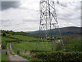
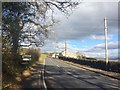
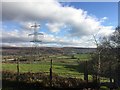
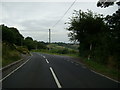
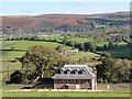
6 photos from this area
Area Information
Key information about the SA4 0YR including its size, population, and administrative classification.
- Area Type
- Postcode
- Area Size
- 1.0 km²
- Population
- 1810
- Population Density
- 131 people/km²
House Prices in SA4 0YR
12
Properties
£398,000
Average Sold Price
£40,000
Lowest Price
£810,000
Highest Price
Showing 12 properties
| Address | Type | Beds | Baths | Last Sale Price | Last Sale Date | |
|---|---|---|---|---|---|---|
| Frongelli House, Llanedi Road, Llanedi, Swansea, SA4 0YR | Detached | 7 | 5 | £810,000 | Jul 2024 | |
| Tyn Llwyn, Llanedi Road, Llanedi, Swansea, SA4 0YR | Farm | 3 | 1 | £350,000 | Jul 2018 | |
| Gelli Gillion, Llanedi Road, Llanedi, Swansea, SA4 0YR | Detached | - | - | £610,000 | May 2008 | |
| Nantyffyn, Llanedi Road, Llanedi, Swansea, SA4 0YR | Land | - | - | £180,000 | Oct 2007 | |
| Sardis Manse, Llanedi Road, Llanedi, Swansea, SA4 0YR | Detached | - | - | £40,000 | Dec 1996 | |
| Tyr Yn, Llanedi Road, Llanedi, Swansea, SA4 0YR | Farm | 3 | 1 | - | - | |
| Sardis Cottage, Llanedi Road, Llanedi, Swansea, SA4 0YR | Cottage | 1 | - | - | - | |
| Sardis Chapel, Llanedi Road, Llanedi, Swansea, SA4 0YR | Detached | - | - | - | - | |
| Ty Bryngelli, Llanedi Road, Llanedi, Swansea, SA4 0YR | house | - | - | - | - | |
| Maes Y Dderwen, Llanedi Road, Llanedi, Swansea, SA4 0YR | Detached | - | - | - | - |
Page 1 of 2
Energy Efficiency in SA4 0YR
Amenities
Schools
| Rank | School | Type | Entry gender | Ages |
|---|
Explore more schools in this area
Go to Schools tabDemographics
Household Size
Two person
most common
Accommodation Type
Houses
most common
Tenure
88
majority
Ethnic Group
White
most common
Religion
N/A
most common
Household Composition
N/A
most common
Age
47
median
Adults (30-64 years)
most common
Household Deprivation
N/A
with no deprivation
NS-SEC
42
in Lower managerial occupations
Explore more demographic insights in this area
Go to Demographics tabPlanning
Planning Constraints
- Flood RiskPremium
- Ramsar Wetland SitesPremium
- Area of Outstanding Natural BeautyPremium
- Protected Nature ReservePremium
- Protected WoodlandPremium
- Crime RiskPremium