Area Overview for SA4 0XE
Photos of SA4 0XE
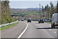
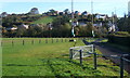
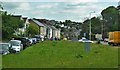
13 photos from this area
Area Information
Key information about the SA4 0XE including its size, population, and administrative classification.
- Area Type
- Postcode
- Area Size
- 3.6 hectares
- Population
- 1666
- Population Density
- 1449 people/km²
House Prices in SA4 0XE
24
Properties
£141,678
Average Sold Price
£38,000
Lowest Price
£335,000
Highest Price
Showing 24 properties
| Address | Type | Beds | Baths | Last Sale Price | Last Sale Date | |
|---|---|---|---|---|---|---|
| 15 Heol Y Parc, Hendy, Swansea, SA4 0XE | Terraced | 3 | 1 | £137,500 | Dec 2023 | |
| 5 Heol Y Parc, Hendy, Swansea, SA4 0XE | Retail | 3 | 2 | £157,000 | Oct 2022 | |
| 4 Heol Y Parc, Hendy, Swansea, SA4 0XE | Retail | 3 | 1 | £335,000 | Aug 2022 | |
| 20 Heol Y Parc, Hendy, Swansea, SA4 0XE | Semi-detached | 3 | 1 | £189,995 | Jan 2022 | |
| 7 Heol Y Parc, Hendy, Swansea, SA4 0XE | house | - | - | £71,000 | Jan 2019 | |
| 27 Heol Y Parc, Hendy, Swansea, SA4 0XE | Detached | 4 | 3 | £230,000 | Nov 2015 | |
| 10 Heol Y Parc, Hendy, Swansea, SA4 0XE | Terraced | 2 | 1 | £123,000 | Oct 2015 | |
| 17 Heol Y Parc, Hendy, Swansea, SA4 0XE | Terraced | 3 | 1 | £72,500 | Jul 2013 | |
| 11 Heol Y Parc, Hendy, Swansea, SA4 0XE | house | - | - | £175,000 | Jul 2011 | |
| 9 Heol Y Parc, Hendy, Swansea, SA4 0XE | Terraced | - | - | £175,000 | Jul 2011 |
Page 1 of 3
Energy Efficiency in SA4 0XE
Amenities
Schools
| Rank | School | Type | Entry gender | Ages |
|---|
Explore more schools in this area
Go to Schools tabDemographics
Household Size
Family (3-5 people)
most common
Accommodation Type
Houses
most common
Tenure
71
majority
Ethnic Group
White
most common
Religion
N/A
most common
Household Composition
N/A
most common
Age
47
median
Adults (30-64 years)
most common
Household Deprivation
N/A
with no deprivation
NS-SEC
30
in Lower managerial occupations
Explore more demographic insights in this area
Go to Demographics tabPlanning
Planning Constraints
- Flood RiskPremium
- Ramsar Wetland SitesPremium
- Area of Outstanding Natural BeautyPremium
- Protected Nature ReservePremium
- Protected WoodlandPremium
- Crime RiskPremium