Area Overview for SA4 0FB
Photos of SA4 0FB
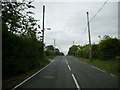
7 photos from this area
Area Information
Key information about the SA4 0FB including its size, population, and administrative classification.
- Area Type
- Postcode
- Area Size
- 76.2 hectares
- Population
- 1810
- Population Density
- 131 people/km²
House Prices in SA4 0FB
11
Properties
£176,484
Average Sold Price
£35,000
Lowest Price
£305,000
Highest Price
Showing 11 properties
| Address | Type | Beds | Baths | Last Sale Price | Last Sale Date | |
|---|---|---|---|---|---|---|
| Brynamlwg, Ebenezer Road, Llanedi, Swansea, SA4 0FB | Retail | 3 | 2 | £305,000 | Mar 2022 | |
| Ebenezer House, Ebenezer Road, Llanedi, Swansea, SA4 0FB | Detached | - | - | £189,451 | Jan 2018 | |
| Hafodwen, Ebenezer Road, Llanedi, Swansea, SA4 0FB | Detached | - | - | £35,000 | Apr 1999 | |
| Pen Y Waun Cottage, Plasnewydd Road, Llanedi, Swansea, SA4 0FB | Detached | - | - | - | - | |
| Pant Y Blodau, Ebenezer Road, Llanedi, Swansea, SA4 0FB | Detached | - | - | - | - | |
| Forge Villa, Ebenezer Road, Llanedi, Swansea, SA4 0FB | Detached | - | - | - | - | |
| London House, Ebenezer Road, Llanedi, Swansea, SA4 0FB | Semi-detached | - | - | - | - | |
| Yr Henffald, Ebenezer Road, Llanedi, Swansea, SA4 0FB | hotel | - | - | - | - | |
| Penygraig, Ebenezer Road, Llanedi, Swansea, SA4 0FB | Detached | - | - | - | - | |
| Plas Y Celyn, Plasnewydd Road, Llanedi, Swansea, SA4 0FB | Detached | - | - | - | - |
Page 1 of 2
Energy Efficiency in SA4 0FB
Amenities
Schools
| Rank | School | Type | Entry gender | Ages |
|---|
Explore more schools in this area
Go to Schools tabDemographics
Household Size
Two person
most common
Accommodation Type
Houses
most common
Tenure
88
majority
Ethnic Group
White
most common
Religion
N/A
most common
Household Composition
N/A
most common
Age
47
median
Adults (30-64 years)
most common
Household Deprivation
N/A
with no deprivation
NS-SEC
42
in Lower managerial occupations
Explore more demographic insights in this area
Go to Demographics tabPlanning
Planning Constraints
- Flood RiskPremium
- Ramsar Wetland SitesPremium
- Area of Outstanding Natural BeautyPremium
- Protected Nature ReservePremium
- Protected WoodlandPremium
- Crime RiskPremium