Area Overview for SA39 9BQ
Photos of SA39 9BQ
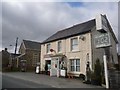
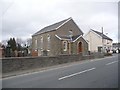
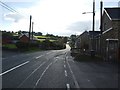
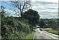
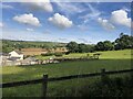
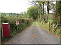
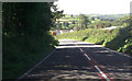
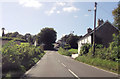

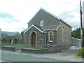
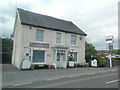
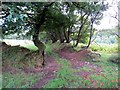
17 photos from this area
Area Information
Key information about the SA39 9BQ including its size, population, and administrative classification.
- Area Type
- Postcode
- Area Size
- 2.8 hectares
- Population
- 1223
- Population Density
- 24 people/km²
House Prices in SA39 9BQ
16
Properties
£110,063
Average Sold Price
£36,000
Lowest Price
£155,000
Highest Price
Showing 16 properties
| Address | Type | Beds | Baths | Last Sale Price | Last Sale Date | |
|---|---|---|---|---|---|---|
| 6 Bro Nantlais, Gwyddgrug, Pencader, SA39 9BQ | Semi-detached | 3 | 1 | £155,000 | Jun 2024 | |
| 3 Bro Nantlais, Gwyddgrug, Pencader, SA39 9BQ | Semi-detached | 3 | 1 | £147,000 | Sep 2019 | |
| 7 Bro Nantlais, Gwyddgrug, Pencader, SA39 9BQ | house | 4 | 2 | £145,000 | Nov 2017 | |
| 16 Bro Nantlais, Gwyddgrug, Pencader, SA39 9BQ | Semi-detached | 3 | 2 | £112,000 | Jul 2017 | |
| 12 Bro Nantlais, Gwyddgrug, Pencader, SA39 9BQ | house | 2 | - | £119,000 | Dec 2012 | |
| Nant-y-grug, 15 Bro Nantlais, Gwyddgrug, Pencader, SA39 9BQ | house | 3 | - | £111,500 | Jun 2011 | |
| 2 Bro Nantlais, Gwyddgrug, Pencader, SA39 9BQ | Semi-detached | - | - | £55,000 | Jul 2002 | |
| 14 Bro Nantlais, Gwyddgrug, Pencader, SA39 9BQ | Semi-detached | - | - | £36,000 | Aug 1996 | |
| 4 Bro Nantlais, Gwyddgrug, Pencader, SA39 9BQ | Semi-detached | - | - | - | - | |
| 13 Bro Nantlais, Gwyddgrug, Pencader, SA39 9BQ | house | - | - | - | - |
Page 1 of 2
Energy Efficiency in SA39 9BQ
Amenities
Schools
| Rank | School | Type | Entry gender | Ages |
|---|
Explore more schools in this area
Go to Schools tabDemographics
Household Size
Two person
most common
Accommodation Type
Houses
most common
Tenure
85
majority
Ethnic Group
White
most common
Religion
N/A
most common
Household Composition
N/A
most common
Age
47
median
Adults (30-64 years)
most common
Household Deprivation
N/A
with no deprivation
NS-SEC
25
in Lower managerial occupations
Explore more demographic insights in this area
Go to Demographics tabPlanning
Planning Constraints
- Flood RiskPremium
- Ramsar Wetland SitesPremium
- Area of Outstanding Natural BeautyPremium
- Protected Nature ReservePremium
- Protected WoodlandPremium
- Crime RiskPremium