Area Overview for SA34 0RT
Photos of SA34 0RT
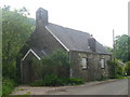
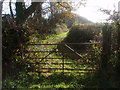
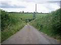
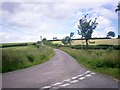
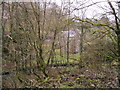
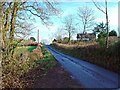
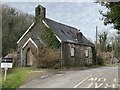
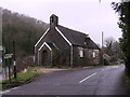
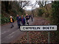
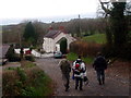
12 photos from this area
Area Information
Key information about the SA34 0RT including its size, population, and administrative classification.
- Area Type
- Postcode
- Area Size
- 2.0 km²
- Population
- 2097
- Population Density
- 21 people/km²
House Prices in SA34 0RT
8
Properties
£220,000
Average Sold Price
£120,000
Lowest Price
£320,000
Highest Price
Showing 8 properties
| Address | Type | Beds | Baths | Last Sale Price | Last Sale Date | |
|---|---|---|---|---|---|---|
| Brynhyfryd, C 3231 From Glandwr To Cwmfelin Boeth, Cwmfelin Boeth, Whitland, SA34 0RT | Detached | 3 | 2 | £120,000 | Jan 2015 | |
| Passbye, U 6209 From, Cwmfelin Boeth, Whitland, SA34 0RT | house | - | - | £320,000 | Nov 2005 | |
| Passbye House, U 6209 From, Cwmfelin Boeth, Whitland, SA34 0RT | Land | 2 | 1 | - | - | |
| Hafan, Whitland Abbey Penyparc C 3231, Whitland, SA34 0RT | Detached | - | - | - | - | |
| Pantyffynnon, C 3231 From Glandwr To Cwmfelin Boeth, Cwmfelin Boeth, Whitland, SA34 0RT | house | - | - | - | - | |
| Coed Howell, C 3231 From Glandwr To Cwmfelin Boeth, Cwmfelin Boeth, Whitland, SA34 0RT | Detached | - | - | - | - | |
| Caravan, Brynhyfryd, C 3231 From Glandwr To Cwmfelin Boeth, Cwmfelin Boeth, Whitland, SA34 0RT | Mobile Home | - | - | - | - | |
| Penlan, U 6209 From, Cwmfelin Boeth, Whitland, SA34 0RT | Detached | - | - | - | - |
Energy Efficiency in SA34 0RT
Amenities
Schools
| Rank | School | Type | Entry gender | Ages |
|---|
Explore more schools in this area
Go to Schools tabDemographics
Household Size
Two person
most common
Accommodation Type
Houses
most common
Tenure
85
majority
Ethnic Group
White
most common
Religion
N/A
most common
Household Composition
N/A
most common
Age
47
median
Adults (30-64 years)
most common
Household Deprivation
N/A
with no deprivation
NS-SEC
28
in Lower managerial occupations
Explore more demographic insights in this area
Go to Demographics tabPlanning
Planning Constraints
- Flood RiskPremium
- Ramsar Wetland SitesPremium
- Area of Outstanding Natural BeautyPremium
- Protected Nature ReservePremium
- Protected WoodlandPremium
- Crime RiskPremium