Area Overview for SA34 0NB
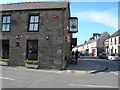
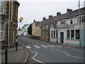
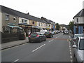
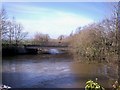
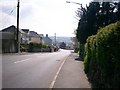
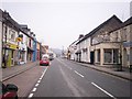
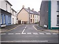
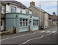
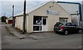
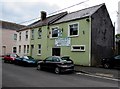
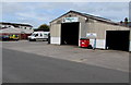
Photos of SA34 0NB

Area Information
Living in SA34 0NB means residing in a specific residential cluster within Wales characterised by a tight-knit community feel. This postcode covers a population of 2,381 people, creating a relatively quiet environment with a low density of 106 people per square kilometre. You will find yourself in an area where daily life moves at a slower pace, distinct from the busier centres of larger towns. The setting offers a sense of stillness that appeals to those seeking a retreat from urban noise. You can expect a neighbourhood where residents know their neighbours and where the built environment is predominantly residential rather than commercial or industrial. This location serves as a stable base for families and professionals who value space and tranquility over high-energy city centres. The area maintains its identity as a cluster of homes rather than a sprawling suburb, preserving a community atmosphere that feels authentic and grounded. For anyone considering buying properties in SA34 0NB, the primary appeal lies in this manageable scale and the potential for a peaceful lifestyle without the compromises of larger, more congested postcodes.
- Area Type
- Postcode
- Area Size
- Not available
- Population
- 2381
- Population Density
- 106 people/km²
The property market in SA34 0NB is heavily skewed towards owner-occupation, a trend confirmed by the 72% home ownership rate. You will find that the vast majority of transactions involve existing homeowners selling to other homeowners rather than landlords renting to tenants. This market structure creates a stable environment where buyers must often compete with current owners who are reluctant to move from their properties. The accommodation type is almost exclusively houses, meaning you will not find purpose-built flats or high-rise developments as part of the regular housing stock. Properties here are likely to be detached or semi-detached homes, suitable for families who value garden space and privacy. For anyone looking to buy homes in SA34 0NB, the market may move more slowly than in rental-heavy zones because the turnover rate is generally lower. Investors looking for short-term rental yields may find fewer opportunities, whereas buyers seeking to establish a permanent residence will face a community where others are also deeply settled in their neighbourhoods.
House Prices in SA34 0NB
No properties found in this postcode.
Energy Efficiency in SA34 0NB
The lifestyle in SA34 0NB centres on practical convenience and local access to essential services. Within practical reach of residents are three railway stations: Whitland Railway Station, Narberth Railway Station, and Clunderwen Railway Station. These rail links provide a direct route into wider networks, though you should verify travel times for your specific destinations. For everyday shopping, four retail outlets are available nearby, including Co-op Whitland, Spar, and Co-op St. These venues offer a range of groceries and household essentials without requiring a significant trip into a major town centre. You will find that daily errands can be completed locally, which supports a slower, more relaxed pace of life. The area does not boast extensive leisure centres or large supermarkets, so your routine will involve planning for larger weekly trips. Despite this, the availability of rail and local shops ensures that isolation is not a concern for those who value self-sufficiency and community interaction over urban convenience.
Amenities
Schools
Families residing in SA34 0NB have access to three notable educational institutions within the immediate vicinity. You can find Henllan Amgoed C.P. School, Ysgol Llys Hywel, and Dyffryn Taf School listed as the nearest educational facilities. These institutions are classified as other types of schools, which typically indicates a mix of primary and possibly specific secondary provisions catering to local needs. The presence of multiple schools suggests a decent range of educational options without necessarily offering every specialisation found in major urban hubs. If you are moving here to raise children, you will need to verify the specific primary or secondary classification of these names during your research, as the data lists them under a broader category. The proximity of these schools means that daily commutes to the classroom are likely short for children living in the residential cluster. This layout allows parents to monitor their child's journey and reduces the time spent on transportation to and from learning environments.
| Rank | School | Type | Entry gender | Ages |
|---|
Explore more schools in this area
Go to Schools tabDemographics
The community in SA34 0NB is defined by an older, established demographic profile. The median age of residents is 47 years, with the most common age range falling between 30 and 64 years. This indicates that the area is largely populated by working adults and retirees rather than young families or transient university students. You will encounter a population where stability is common, as evidenced by a home ownership rate of 72%. This high percentage suggests that many residents have settled permanently and are investing in their long-term future in Wales. The primary accommodation type consists of houses, reinforcing the image of a traditional residential neighbourhood rather than a high-density apartment block zone. The predominant ethnic group is White, reflecting the typical demographic makeup of rural and semi-rural Welsh towns. These statistics paint a picture of a mature community where neighbours have likely lived there for decades, fostering strong local bonds and a shared history that is absent from areas with high population turnover or younger demographics.
Household Size
Accommodation Type
Tenure
Ethnic Group
Religion
Household Composition
Age
Household Deprivation
NS-SEC
Explore more demographic insights in this area
Go to Demographics tabPlanning
Planning Constraints
- Flood RiskPremium
- Ramsar Wetland SitesPremium
- Area of Outstanding Natural BeautyPremium
- Protected Nature ReservePremium
- Protected WoodlandPremium
- Crime RiskPremium