Area Overview for SA34 0LJ
Photos of SA34 0LJ
Area Information
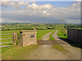
Living in SA34 0LJ means residing in a very small residential cluster in Wales that covers just 40.6 hectares. With a population of 2097, this postcode represents a tightly knit community rather than a sprawling suburb. The low population density of 21 people per square kilometre indicates a spread-out settlement where properties do not stand shoulder to shoulder. You will find a village atmosphere here, defined by its compactness and proximity to rural surroundings. Daily life revolves around a quiet pace, suitable for those who prefer a quieter existence away from the noise of larger towns. The area is situated in the Swansea postcode region, offering a distinct character within the broader coastal landscape of West Wales. Buy here if you seek a specific, contained environment where the boundaries of the neighbourhood are clearly defined by its small physical footprint. This location suits individuals looking for a traditional rural or semi-rural setting without the infrastructure of a large urban centre.
- Area Type
- Postcode
- Area Size
- 40.6 hectares
- Population
- 2097
- Population Density
- 21 people/km²
The property market in SA34 0LJ is defined by a high concentration of houses suited for living rather than short-term letting. With 85% of homes in this postcode owned by residents, the area functions primarily as an owner-occupied market. This indicates that the housing stock is likely stable, with fewer short-term rental turnovers typical of holiday hotspots. Buyers looking at homes in SA34 0LJ will find a stock dominated by family-sized properties rather than high-density flats. The 40.6 hectares of land suggest a dependency on the surrounding region for wider housing options, as this specific cluster is too small to sustain a complex internal market. The prevalence of house ownership points to an area where capital growth and long-term equity are primary drivers for sellers. Potential buyers seeking to move into this community should expect to compete with other residents who have lived here for a long time, rather than fighting against a volatile rental landlord market.
House Prices in SA34 0LJ
Showing 5 properties
| Address | Type | Beds | Baths | Last Sale Price | Last Sale Date | |
|---|---|---|---|---|---|---|
| Cwrt Y Celin, C 3223 From Llanboidy To Whitland, Llanboidy, Whitland, SA34 0LJ | Land | 3 | 3 | £345,000 | Dec 2016 | |
| Brynemlyn, C 3223 From Llanboidy To Whitland, Llanboidy, Whitland, SA34 0LJ | Detached | 2 | - | - | - | |
| Castell Pigyn, C 3223 From Llanboidy To Whitland, Llanboidy, Whitland, SA34 0LJ | Detached | - | - | - | - | |
| Horton House, C 3223 From Llanboidy To Whitland, Llanboidy, Whitland, SA34 0LJ | Detached | - | - | - | - | |
| Cottage, Castell Pigyn, C 3223 From Llanboidy To Whitland, Llanboidy, Whitland, SA34 0LJ | Detached | - | - | - | - |
Energy Efficiency in SA34 0LJ
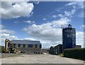
Residents of SA34 0LJ can access essential retail and transport facilities within a short practical reach. For daily shopping needs, you have a selection of four notable retail outlets located nearby, specifically Co-op Whitland, Co-op St, and Spar. These stores provide the basics without requiring a long journey into a major urban centre. Transport connectivity is supported by two railway stations close by: Whitland Railway Station and Clunderwen Railway Station. These rail links offer exits and entries from the area, connecting you to wider rail networks beyond the immediate locality. The proximity of these amenities means that weekend trips or quick errands do not require a car for every single task. While the immediate vicinity is residential, the presence of these named venues ensures that food, household goods, and occasional travel needs are met conveniently. This balance of local sustenance and external access defines the lifestyle in this small cluster.
Amenities
Schools
Families considering schools near SA34 0LJ have access to several educational institutions within practical reach. The nearest options include Llangynin C.P. School, Ysgol Gynradd Llanboidy, Ysgol Beca, and Ysgol Bro Brynach. All four of these facilities are listed as 'other' type schools, which typically denotes primary, community, or preparatory institutions rather than secondary academies. This classification suggests that the immediate vicinity surrounding SA34 0LJ serves as a catchment area for younger children before they transfer to larger secondary establishments further away. The mix of named institutions like Llangynin and Ysgol Beca provides local educational hubs that are likely integrated into the community fabric. Parents in this area will need to consider travel time to secondary education, as the listed schools do not cover the full spectrum of compulsory schooling. Check the specific catchment boundaries for these named schools to ensure they align with your family's address in WA34 0LJ.
| Rank | School | Type | Entry gender | Ages |
|---|
Explore more schools in this area
Go to Schools tabDemographics
The community in SA34 0LJ is dominated by adults aged between 30 and 64 years old. This age profile creates a settled environment with a median age of 47, reflecting a population that has put down roots rather than a transient student or young professional demographic. Home ownership is exceptionally high at 85%, meaning the vast majority of residents own their homes outright or with a mortgage rather than renting. This stability suggests a strong attachment to the local area and a community where long-term residents make up the backbone. Houses form the primary accommodation type, reinforcing the traditional, family-oriented nature of the housing stock. The population is predominantly White, consistent with the broader Welsh demographic trends. This skew towards an older, owner-occupying population implies a neighbourhood where change happens gradually and where you are likely to meet the same neighbours for decades.
Household Size
Accommodation Type
Tenure
Ethnic Group
Religion
Household Composition
Age
Household Deprivation
NS-SEC
Explore more demographic insights in this area
Go to Demographics tabPlanning
Planning Constraints
- Flood RiskPremium
- Ramsar Wetland SitesPremium
- Area of Outstanding Natural BeautyPremium
- Protected Nature ReservePremium
- Protected WoodlandPremium
- Crime RiskPremium