Area Overview for SA33 6BD
Photos of SA33 6BD


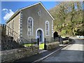
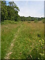
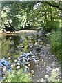


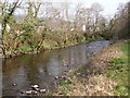
31 photos from this area
Area Information
Key information about the SA33 6BD including its size, population, and administrative classification.
- Area Type
- Postcode
- Area Size
- 9.4 hectares
- Population
- 1526
- Population Density
- 35 people/km²
House Prices in SA33 6BD
29
Properties
£196,731
Average Sold Price
£124,000
Lowest Price
£345,000
Highest Price
Showing 29 properties
| Address | Type | Beds | Baths | Last Sale Price | Last Sale Date | |
|---|---|---|---|---|---|---|
| The Pebbles, Bronwydd To Pontarsais, Bronwydd, Carmarthen, SA33 6BD | Terraced | 3 | 1 | £143,000 | Sep 2024 | |
| Ynys Glyd, Bronwydd To Pontarsais, Bronwydd, Carmarthen, SA33 6BD | Bungalow | 3 | - | £245,000 | Apr 2021 | |
| Berllan Gwili, Bronwydd To Pontarsais, Bronwydd, Carmarthen, SA33 6BD | Semi-detached | 3 | 1 | £173,000 | Sep 2019 | |
| Swn Yr Afon, Bronwydd To Pontarsais, Bronwydd, Carmarthen, SA33 6BD | Bungalow | 3 | 1 | £152,500 | Apr 2019 | |
| Wessenden, Bronwydd To Pontarsais, Bronwydd, Carmarthen, SA33 6BD | Bungalow | 4 | 2 | £180,000 | May 2018 | |
| Brynderw, Bronwydd To Pontarsais, Bronwydd, Carmarthen, SA33 6BD | Detached | 4 | 2 | £345,000 | Sep 2017 | |
| Meadow Croft, Bronwydd To Pontarsais, Bronwydd, Carmarthen, SA33 6BD | house | - | - | £210,000 | Jan 2017 | |
| Bronfa, Bronwydd To Pontarsais, Bronwydd, Carmarthen, SA33 6BD | Detached | 3 | 3 | £210,000 | Sep 2015 | |
| River Lea, Bronwydd To Pontarsais, Bronwydd, Carmarthen, SA33 6BD | Terraced | 3 | - | £124,000 | Feb 2015 | |
| Maesteg, Bronwydd To Pontarsais, Bronwydd, Carmarthen, SA33 6BD | Bungalow | - | - | £152,500 | Feb 2013 |
Page 1 of 3
Energy Efficiency in SA33 6BD
Amenities
Schools
| Rank | School | Type | Entry gender | Ages |
|---|
Explore more schools in this area
Go to Schools tabDemographics
Household Size
Two person
most common
Accommodation Type
Houses
most common
Tenure
84
majority
Ethnic Group
White
most common
Religion
N/A
most common
Household Composition
N/A
most common
Age
47
median
Adults (30-64 years)
most common
Household Deprivation
N/A
with no deprivation
NS-SEC
31
in Lower managerial occupations
Explore more demographic insights in this area
Go to Demographics tabPlanning
Planning Constraints
- Flood RiskPremium
- Ramsar Wetland SitesPremium
- Area of Outstanding Natural BeautyPremium
- Protected Nature ReservePremium
- Protected WoodlandPremium
- Crime RiskPremium