Area Overview for SA33 6AJ
Photos of SA33 6AJ
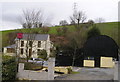

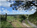


5 photos from this area
Area Information
Key information about the SA33 6AJ including its size, population, and administrative classification.
- Area Type
- Postcode
- Area Size
- 1.1 km²
- Population
- 1526
- Population Density
- 35 people/km²
House Prices in SA33 6AJ
14
Properties
£215,000
Average Sold Price
£100,000
Lowest Price
£350,000
Highest Price
Showing 14 properties
| Address | Type | Beds | Baths | Last Sale Price | Last Sale Date | |
|---|---|---|---|---|---|---|
| Pantyrhedyn Cottage, C 2038 From Carmarthen To Meidrim, Carmarthen, SA33 6AJ | Bungalow | - | - | £195,000 | May 2023 | |
| Maesawelon, C 2038 From Carmarthen To Meidrim, Carmarthen, SA33 6AJ | house | - | - | £350,000 | May 2019 | |
| Llyscennen, C 2038 From Carmarthen To Meidrim, Carmarthen, SA33 6AJ | Detached | - | - | £100,000 | Jan 2007 | |
| Pantyrhedyn, C 2038 From Carmarthen To Meidrim, Carmarthen, SA33 6AJ | house | 3 | 1 | - | - | |
| Maes-yr-onnen, C 2038 From Carmarthen To Meidrim, Carmarthen, SA33 6AJ | Farm | 4 | 1 | - | - | |
| Tirbanol, C 2038 From Carmarthen To Meidrim, Carmarthen, SA33 6AJ | Detached | - | - | - | - | |
| Home Meadow Kennels, C 2038 From Carmarthen To Meidrim, Carmarthen, SA33 6AJ | commercial | - | - | - | - | |
| Brynseiri, C 2038 From Carmarthen To Meidrim, Carmarthen, SA33 6AJ | Flat | 1 | - | - | - | |
| Asheldon, C 2038 From Carmarthen To Meidrim, Carmarthen, SA33 6AJ | house | 1 | - | - | - | |
| Home Meadow Farm, C 2038 From Carmarthen To Meidrim, Carmarthen, SA33 6AJ | house | - | - | - | - |
Page 1 of 2
Energy Efficiency in SA33 6AJ
Amenities
Schools
| Rank | School | Type | Entry gender | Ages |
|---|
Explore more schools in this area
Go to Schools tabDemographics
Household Size
Two person
most common
Accommodation Type
Houses
most common
Tenure
84
majority
Ethnic Group
White
most common
Religion
N/A
most common
Household Composition
N/A
most common
Age
47
median
Adults (30-64 years)
most common
Household Deprivation
N/A
with no deprivation
NS-SEC
31
in Lower managerial occupations
Explore more demographic insights in this area
Go to Demographics tabPlanning
Planning Constraints
- Flood RiskPremium
- Ramsar Wetland SitesPremium
- Area of Outstanding Natural BeautyPremium
- Protected Nature ReservePremium
- Protected WoodlandPremium
- Crime RiskPremium