Area Overview for SA33 4PN
Photos of SA33 4PN
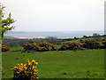
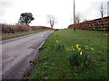
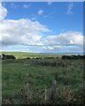
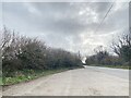
4 photos from this area
Area Information
Key information about the SA33 4PN including its size, population, and administrative classification.
- Area Type
- Postcode
- Area Size
- 4.5 km²
- Population
- 1490
- Population Density
- 20 people/km²
House Prices in SA33 4PN
27
Properties
£599,000
Average Sold Price
£115,000
Lowest Price
£1,100,000
Highest Price
Showing 27 properties
| Address | Type | Beds | Baths | Last Sale Price | Last Sale Date | |
|---|---|---|---|---|---|---|
| Garth Mair Farm, C 3206 From Pendine To Amroth, Pendine, Carmarthen, SA33 4PN | Bungalow | - | - | £1,100,000 | Sep 2022 | |
| GOLWG Y MOR, C 3206 FROM PENDINE TO AMROTH, Pendine, Carmarthen, SA33 4PN | Bungalow | 5 | 5 | £582,000 | Aug 2021 | |
| Marros Hill Farm, C 3206 From Pendine To Amroth, Pendine, Carmarthen, SA33 4PN | park_home | - | - | £115,000 | May 1996 | |
| Pleasant Vale, C 3206 From Pendine To Amroth, Pendine, Carmarthen, SA33 4PN | Land | 1 | 1 | - | - | |
| Caravan At Ciliau Coch, C 3206 From Pendine To Amroth, Pendine, Carmarthen, SA33 4PN | Farm | 3 | 2 | - | - | |
| Ardenmore, C 3206 From Pendine To Amroth, Pendine, Carmarthen, SA33 4PN | Land | - | - | - | - | |
| Stockwell, C 3206 From Pendine To Amroth, Pendine, Carmarthen, SA33 4PN | Detached | 5 | 3 | - | - | |
| Ciliau Coch, C 3206 From Pendine To Amroth, Pendine, Carmarthen, SA33 4PN | Land | - | - | - | - | |
| Garness Bungalow, C 3206 From Pendine To Amroth, Pendine, Carmarthen, SA33 4PN | Bungalow | - | - | - | - | |
| Ragwen Point Bungalow, C 3206 From Pendine To Amroth, Pendine, Carmarthen, SA33 4PN | Detached | - | - | - | - |
Page 1 of 3
Energy Efficiency in SA33 4PN
Amenities
Schools
| Rank | School | Type | Entry gender | Ages |
|---|
Explore more schools in this area
Go to Schools tabDemographics
Household Size
Two person
most common
Accommodation Type
Houses
most common
Tenure
71
majority
Ethnic Group
White
most common
Religion
N/A
most common
Household Composition
N/A
most common
Age
47
median
Adults (30-64 years)
most common
Household Deprivation
N/A
with no deprivation
NS-SEC
25
in Lower managerial occupations
Explore more demographic insights in this area
Go to Demographics tabPlanning
Planning Constraints
- Flood RiskPremium
- Ramsar Wetland SitesPremium
- Area of Outstanding Natural BeautyPremium
- Protected Nature ReservePremium
- Protected WoodlandPremium
- Crime RiskPremium