Area Overview for SA33 4AX
Photos of SA33 4AX
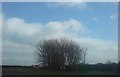
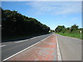
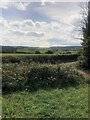
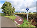
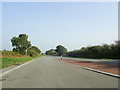
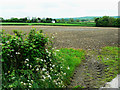
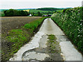
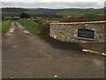
9 photos from this area
Area Information
Key information about the SA33 4AX including its size, population, and administrative classification.
- Area Type
- Postcode
- Area Size
- 2.1 km²
- Population
- 1822
- Population Density
- 137 people/km²
House Prices in SA33 4AX
24
Properties
£263,389
Average Sold Price
£90,000
Lowest Price
£418,000
Highest Price
Showing 24 properties
| Address | Type | Beds | Baths | Last Sale Price | Last Sale Date | |
|---|---|---|---|---|---|---|
| Delfan, Lon Llysalaw, Pwll Trap, Carmarthen, SA33 4AX | Detached | 3 | 2 | £270,000 | Oct 2025 | |
| Ardwyn, Lon Llysalaw, Pwll Trap, Carmarthen, SA33 4AX | Bungalow | 4 | 1 | £310,000 | Mar 2025 | |
| Kings Park Farm, St Clears To Whitland, St Clears, Carmarthen, SA33 4AX | house | 6 | 2 | £280,000 | Oct 2021 | |
| Moondarra, Lon Llysalaw, Pwll Trap, Carmarthen, SA33 4AX | Bungalow | 3 | 2 | £320,000 | Dec 2020 | |
| Arhosfan, Lon Llysalaw, Pwll Trap, Carmarthen, SA33 4AX | Bungalow | 5 | 2 | £295,000 | Feb 2017 | |
| Llysalaw, Lon Llysalaw, Pwll Trap, Carmarthen, SA33 4AX | Bungalow | 3 | 3 | £150,000 | Sep 2015 | |
| Courtlands, Lon Llysalaw, Pwll Trap, Carmarthen, SA33 4AX | Bungalow | 3 | - | £237,500 | Jan 2014 | |
| Llwyndu, Lon Llysalaw, Pwll Trap, Carmarthen, SA33 4AX | house | - | - | £90,000 | May 2013 | |
| Gors Farm, 0 , Pwlltrap, St. Clears, Carmarthen, SA33 4AX | Land | - | - | £418,000 | Oct 2009 | |
| Sabulon, U 6218 From A 40 T, St Clears, Carmarthen, SA33 4AX | Land | - | - | - | - |
Page 1 of 3
Energy Efficiency in SA33 4AX
Amenities
Schools
| Rank | School | Type | Entry gender | Ages |
|---|
Explore more schools in this area
Go to Schools tabDemographics
Household Size
Two person
most common
Accommodation Type
Houses
most common
Tenure
74
majority
Ethnic Group
White
most common
Religion
N/A
most common
Household Composition
N/A
most common
Age
47
median
Adults (30-64 years)
most common
Household Deprivation
N/A
with no deprivation
NS-SEC
29
in Lower managerial occupations
Explore more demographic insights in this area
Go to Demographics tabPlanning
Planning Constraints
- Flood RiskPremium
- Ramsar Wetland SitesPremium
- Area of Outstanding Natural BeautyPremium
- Protected Nature ReservePremium
- Protected WoodlandPremium
- Crime RiskPremium