Area Overview for SA32 8ES
Photos of SA32 8ES

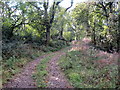
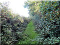
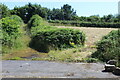
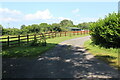
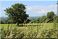
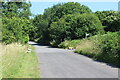


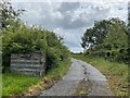
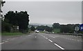
11 photos from this area
Area Information
Key information about the SA32 8ES including its size, population, and administrative classification.
- Area Type
- Postcode
- Area Size
- 61.7 hectares
- Population
- 1499
- Population Density
- 66 people/km²
House Prices in SA32 8ES
24
Properties
£201,316
Average Sold Price
£155,000
Lowest Price
£250,000
Highest Price
Showing 24 properties
| Address | Type | Beds | Baths | Last Sale Price | Last Sale Date | |
|---|---|---|---|---|---|---|
| Aweldeg, U 2190 From, Carmarthen, SA32 8ES | Bungalow | - | - | £180,950 | Jul 2021 | |
| Llwyn Haf, C 2071 From Nantycaws To Llanddarog, Nantycaws, Carmarthen, SA32 8ES | Bungalow | 3 | 1 | £155,000 | Dec 2017 | |
| Penllain, U 2190 From, Carmarthen, SA32 8ES | house | 4 | 2 | £197,000 | Oct 2014 | |
| Nantlle, C 2071 From Nantycaws To Llanddarog, Nantycaws, Carmarthen, SA32 8ES | house | - | - | £250,000 | Jul 2011 | |
| Neuadd Wen, C 2071 From Nantycaws To Llanddarog, Nantycaws, Carmarthen, SA32 8ES | Bungalow | - | - | £174,995 | Dec 2009 | |
| Ty Nant, C 2071 From Nantycaws To Llanddarog, Nantycaws, Carmarthen, SA32 8ES | Detached | - | - | £249,950 | Jan 2005 | |
| Ridgeway, C 2071 From Nantycaws To Llanddarog, Nantycaws, Carmarthen, SA32 8ES | Bungalow | 4 | 2 | - | - | |
| Copa, C 2071 From Nantycaws To Llanddarog, Nantycaws, Carmarthen, SA32 8ES | Detached | 6 | 1 | - | - | |
| Ty Newydd, C 2071 From Nantycaws To Llanddarog, Nantycaws, Carmarthen, SA32 8ES | Semi-detached | 3 | 2 | - | - | |
| Ty Ar Y Bryn, C 2071 From Nantycaws To Llanddarog, Nantycaws, Carmarthen, SA32 8ES | Detached | 4 | 2 | - | - |
Page 1 of 3
Energy Efficiency in SA32 8ES
Amenities
Schools
| Rank | School | Type | Entry gender | Ages |
|---|
Explore more schools in this area
Go to Schools tabDemographics
Household Size
Two person
most common
Accommodation Type
Houses
most common
Tenure
86
majority
Ethnic Group
White
most common
Religion
N/A
most common
Household Composition
N/A
most common
Age
47
median
Adults (30-64 years)
most common
Household Deprivation
N/A
with no deprivation
NS-SEC
39
in Lower managerial occupations
Explore more demographic insights in this area
Go to Demographics tabPlanning
Planning Constraints
- Flood RiskPremium
- Ramsar Wetland SitesPremium
- Area of Outstanding Natural BeautyPremium
- Protected Nature ReservePremium
- Protected WoodlandPremium
- Crime RiskPremium