Area Overview for SA32 8AD
Photos of SA32 8AD
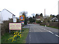
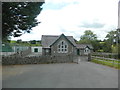
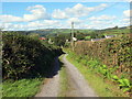
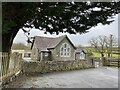
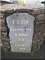
7 photos from this area
Area Information
Key information about the SA32 8AD including its size, population, and administrative classification.
- Area Type
- Postcode
- Area Size
- 1.9 km²
- Population
- 2070
- Population Density
- 47 people/km²
House Prices in SA32 8AD
61
Properties
£312,938
Average Sold Price
£58,000
Lowest Price
£1,797,000
Highest Price
Showing 61 properties
| Address | Type | Beds | Baths | Last Sale Price | Last Sale Date | |
|---|---|---|---|---|---|---|
| Rhyd Adlais, Llangynnor Capel Dewi, Capel Dewi, Carmarthen, SA32 8AD | Bungalow | - | - | £240,000 | Aug 2025 | |
| Minyffordd, Llangynnor Capel Dewi, Capel Dewi, Carmarthen, SA32 8AD | Bungalow | - | - | £350,000 | Aug 2024 | |
| Maes Mihathan, Capel Dewi To Llanarthney, Capel Dewi, Carmarthen, SA32 8AD | house | - | - | £350,000 | Aug 2024 | |
| Drws Y Coed, Llangynnor Capel Dewi, Capel Dewi, Carmarthen, SA32 8AD | Bungalow | 3 | 1 | £280,000 | Jul 2024 | |
| Yr Hafan, Capel Dewi B 4300 To Bryncrwn, Capel Dewi, Carmarthen, SA32 8AD | Bungalow | - | - | £560,000 | Jan 2024 | |
| Springfield, Llangynnor Capel Dewi, Capel Dewi, Carmarthen, SA32 8AD | Bungalow | 3 | 1 | £300,000 | Sep 2023 | |
| Oak Vale, Capel Dewi B 4300 To Bryncrwn, Capel Dewi, Carmarthen, SA32 8AD | Bungalow | 3 | 3 | £535,000 | May 2023 | |
| Capel Dewi Isaf, Llangynnor Capel Dewi, Capel Dewi, Carmarthen, SA32 8AD | house | - | - | £1,797,000 | Feb 2023 | |
| Old Chapel, Llangynnor Capel Dewi, Capel Dewi, Carmarthen, SA32 8AD | Flat | 2 | 3 | £300,000 | Jan 2023 | |
| Delfryn, Llangynnor Capel Dewi, Capel Dewi, Carmarthen, SA32 8AD | Detached | 3 | 1 | £340,000 | Oct 2022 |
Page 1 of 7
Energy Efficiency in SA32 8AD
Amenities
Schools
| Rank | School | Type | Entry gender | Ages |
|---|
Explore more schools in this area
Go to Schools tabDemographics
Household Size
Two person
most common
Accommodation Type
Houses
most common
Tenure
80
majority
Ethnic Group
White
most common
Religion
N/A
most common
Household Composition
N/A
most common
Age
47
median
Adults (30-64 years)
most common
Household Deprivation
N/A
with no deprivation
NS-SEC
37
in Lower managerial occupations
Explore more demographic insights in this area
Go to Demographics tabPlanning
Planning Constraints
- Flood RiskPremium
- Ramsar Wetland SitesPremium
- Area of Outstanding Natural BeautyPremium
- Protected Nature ReservePremium
- Protected WoodlandPremium
- Crime RiskPremium