Area Overview for SA32 7LG
Photos of SA32 7LG
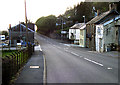
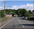
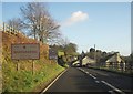
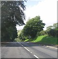

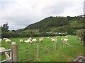

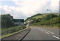
18 photos from this area
Area Information
Key information about the SA32 7LG including its size, population, and administrative classification.
- Area Type
- Postcode
- Area Size
- 64.1 hectares
- Population
- 1396
- Population Density
- 42 people/km²
House Prices in SA32 7LG
61
Properties
£257,935
Average Sold Price
£85,000
Lowest Price
£520,000
Highest Price
Showing 61 properties
| Address | Type | Beds | Baths | Last Sale Price | Last Sale Date | |
|---|---|---|---|---|---|---|
| Awel Y Deri, Station Road, Nantgaredig, Carmarthen, SA32 7LG | Bungalow | 3 | 1 | £375,000 | May 2025 | |
| Dolafon, Station Road, Nantgaredig, Carmarthen, SA32 7LG | house | 3 | 1 | £275,000 | Apr 2025 | |
| The Paddock, Station Road, Nantgaredig, Carmarthen, SA32 7LG | Bungalow | 3 | 1 | £375,000 | Jul 2024 | |
| Milsom House, Station Road, Nantgaredig, Carmarthen, SA32 7LG | Detached | 4 | 2 | £520,000 | Mar 2024 | |
| Y Buarth, Station Road, Nantgaredig, Carmarthen, SA32 7LG | Bungalow | - | - | £425,000 | Jun 2023 | |
| Tanybryn, Station Road, Nantgaredig, Carmarthen, SA32 7LG | Terraced | 3 | 1 | £180,000 | Nov 2022 | |
| Plaspant, Station Road, Nantgaredig, Carmarthen, SA32 7LG | house | - | - | £178,000 | Jun 2022 | |
| Portfield, Station Road, Nantgaredig, Carmarthen, SA32 7LG | Retail | 4 | 1 | £365,000 | Apr 2022 | |
| Awelon, Station Road, Nantgaredig, Carmarthen, SA32 7LG | house | - | - | £150,000 | Mar 2022 | |
| Y Goedlan, Station Road, Nantgaredig, Carmarthen, SA32 7LG | Detached | 3 | 1 | £273,000 | Sep 2021 |
Page 1 of 7
Energy Efficiency in SA32 7LG
Amenities
Schools
| Rank | School | Type | Entry gender | Ages |
|---|
Explore more schools in this area
Go to Schools tabDemographics
Household Size
Two person
most common
Accommodation Type
Houses
most common
Tenure
83
majority
Ethnic Group
White
most common
Religion
N/A
most common
Household Composition
N/A
most common
Age
47
median
Adults (30-64 years)
most common
Household Deprivation
N/A
with no deprivation
NS-SEC
40
in Lower managerial occupations
Explore more demographic insights in this area
Go to Demographics tabPlanning
Planning Constraints
- Flood RiskPremium
- Ramsar Wetland SitesPremium
- Area of Outstanding Natural BeautyPremium
- Protected Nature ReservePremium
- Protected WoodlandPremium
- Crime RiskPremium