Area Overview for SA32 7EE
Photos of SA32 7EE
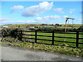
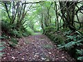

7 photos from this area
Area Information
Key information about the SA32 7EE including its size, population, and administrative classification.
- Area Type
- Postcode
- Area Size
- 1.5 km²
- Population
- 1557
- Population Density
- 41 people/km²
House Prices in SA32 7EE
11
Properties
£260,000
Average Sold Price
£260,000
Lowest Price
£260,000
Highest Price
Showing 11 properties
| Address | Type | Beds | Baths | Last Sale Price | Last Sale Date | |
|---|---|---|---|---|---|---|
| Gwarcwm, Maeslan To Pantllyn, Alltwalis, Carmarthen, SA32 7EE | house | - | - | £260,000 | Jan 2013 | |
| Caravan, Penrhiw, Alltwalis To Gwyddgrug, Alltwalis, Carmarthen, SA32 7EE | Mobile Home | - | - | - | - | |
| Maes-lan, Maeslan To Pantllyn, Alltwalis, Carmarthen, SA32 7EE | Detached | - | - | - | - | |
| Rhoswen, Coedllwydion Road, Alltwalis, Carmarthen, SA32 7EE | Detached | - | - | - | - | |
| Bryn-y-wawr, Alltwalis Blaencarnafan C 1305, Alltwalis, Carmarthen, SA32 7EE | Bungalow | - | - | - | - | |
| Pant-llyn, Maeslan To Pantllyn, Alltwalis, Carmarthen, SA32 7EE | Detached | - | - | - | - | |
| Plas Newydd, Alltwalis To Gwyddgrug, Alltwalis, Carmarthen, SA32 7EE | Detached | - | - | - | - | |
| A Thomas Plant Hire Limited, Old Concrete Works, Alltwalis Blaencarnafan C 1305, Alltwalis, Carmarthen, SA32 7EE | warehouse | - | - | - | - | |
| Penrhiw, Alltwalis To Gwyddgrug, Alltwalis, Carmarthen, SA32 7EE | Detached | - | - | - | - | |
| Caravan, Penrhiw, Alltwalis To Gwyddgrug, Alltwalis, Carmarthen, SA32 7EE | Mobile Home | - | - | - | - |
Page 1 of 2
Energy Efficiency in SA32 7EE
Amenities
Schools
| Rank | School | Type | Entry gender | Ages |
|---|
Explore more schools in this area
Go to Schools tabDemographics
Household Size
Two person
most common
Accommodation Type
Houses
most common
Tenure
69
majority
Ethnic Group
White
most common
Religion
N/A
most common
Household Composition
N/A
most common
Age
47
median
Adults (30-64 years)
most common
Household Deprivation
N/A
with no deprivation
NS-SEC
23
in Lower managerial occupations
Explore more demographic insights in this area
Go to Demographics tabPlanning
Planning Constraints
- Flood RiskPremium
- Ramsar Wetland SitesPremium
- Area of Outstanding Natural BeautyPremium
- Protected Nature ReservePremium
- Protected WoodlandPremium
- Crime RiskPremium