Area Overview for SA31 3RR
Photos of SA31 3RR
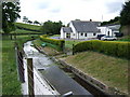
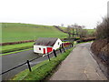
2 photos from this area
Area Information
Key information about the SA31 3RR including its size, population, and administrative classification.
- Area Type
- Postcode
- Area Size
- 1.1 km²
- Population
- 1880
- Population Density
- 249 people/km²
House Prices in SA31 3RR
7
Properties
£361,000
Average Sold Price
£300,000
Lowest Price
£422,000
Highest Price
Showing 7 properties
| Address | Type | Beds | Baths | Last Sale Price | Last Sale Date | |
|---|---|---|---|---|---|---|
| Waundolau, Llysonnen Road To St Peters, St Peters, Carmarthen, SA31 3RR | Bungalow | 3 | 2 | £422,000 | Mar 2023 | |
| Frondeg, Llysonnen Road To St Peters, St Peters, Carmarthen, SA31 3RR | Bungalow | - | - | £300,000 | Aug 2004 | |
| Trebersed Mill, 0 , St. Peters, Carmarthen, SA31 3RR | house | 4 | 1 | - | - | |
| Trebersed Farmhouse, Llysonnen Road To St Peters, St Peters, Carmarthen, SA31 3RR | office_workshop | - | - | - | - | |
| Gerfanwy, Llysonnen Road To St Peters, St Peters, Carmarthen, SA31 3RR | Detached | - | - | - | - | |
| Ty Pair, Trebersed Farmhouse, Llysonnen Road To St Peters, St Peters, Carmarthen, SA31 3RR | Detached | - | - | - | - | |
| Workshop, Cwmau Bach, Llysonnen Road To St Peters, St Peters, Carmarthen, SA31 3RR | Industrial | - | - | - | - |
Energy Efficiency in SA31 3RR
Amenities
Schools
| Rank | School | Type | Entry gender | Ages |
|---|
Explore more schools in this area
Go to Schools tabDemographics
Household Size
Two person
most common
Accommodation Type
Houses
most common
Tenure
69
majority
Ethnic Group
White
most common
Religion
N/A
most common
Household Composition
N/A
most common
Age
47
median
Adults (30-64 years)
most common
Household Deprivation
N/A
with no deprivation
NS-SEC
34
in Lower managerial occupations
Explore more demographic insights in this area
Go to Demographics tabPlanning
Planning Constraints
- Flood RiskPremium
- Ramsar Wetland SitesPremium
- Area of Outstanding Natural BeautyPremium
- Protected Nature ReservePremium
- Protected WoodlandPremium
- Crime RiskPremium