Area Overview for SA31 3RB
Photos of SA31 3RB

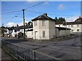
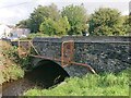
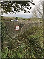

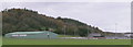
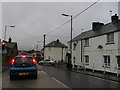

19 photos from this area
Area Information
Key information about the SA31 3RB including its size, population, and administrative classification.
- Area Type
- Postcode
- Area Size
- 21.0 hectares
- Population
- 1761
- Population Density
- 341 people/km²
House Prices in SA31 3RB
11
Properties
-
Average Sold Price
-
Lowest Price
-
Highest Price
Showing 11 properties
| Address | Type | Beds | Baths | Last Sale Price | Last Sale Date | |
|---|---|---|---|---|---|---|
| Unit 6, Cillefwr Industrial Estate, Johnstown, Carmarthen, SA31 3RB | storage_distribution | - | - | - | - | |
| Suite A Ground Floor, Glien House, Glien Road, Johnstown, Carmarthen, SA31 3RB | Office | - | - | - | - | |
| Suite C Ground Floor, Glien House, Glien Road, Johnstown, Carmarthen, SA31 3RB | Office | - | - | - | - | |
| Suite F Ground Floor, Glien House, Glien Road, Johnstown, Carmarthen, SA31 3RB | Office | - | - | - | - | |
| John Davidson Pipes Limited, Units 2 And 3, Glien Road, Johnstown, Carmarthen, SA31 3RB | general_industrial | - | - | - | - | |
| Unit 2, Cillefwr Industrial Estate, Johnstown, Carmarthen, SA31 3RB | general_industrial | - | - | - | - | |
| Fmp Motor Factors Ltd, Unit 14A, Anthony Way, Cillefwr Industrial Estate, Johnstown, Carmarthen, SA31 3RB | Industrial | - | - | - | - | |
| Plot 9, Cillefwr Road East, Cillefwr Industrial Estate, Carmarthen, SA31 3RB | Industrial | - | - | - | - | |
| Unit 1, Parc Las, Alltycnap Road, Johnstown, Carmarthen, SA31 3RB | warehouse | - | - | - | - | |
| Suite G Ground Floor, Glien House, Glien Road, Johnstown, Carmarthen, SA31 3RB | Office | - | - | - | - |
Page 1 of 2
Energy Efficiency in SA31 3RB
Amenities
Schools
| Rank | School | Type | Entry gender | Ages |
|---|
Explore more schools in this area
Go to Schools tabDemographics
Household Size
Two person
most common
Accommodation Type
Houses
most common
Tenure
75
majority
Ethnic Group
White
most common
Religion
N/A
most common
Household Composition
N/A
most common
Age
47
median
Adults (30-64 years)
most common
Household Deprivation
N/A
with no deprivation
NS-SEC
34
in Lower managerial occupations
Explore more demographic insights in this area
Go to Demographics tabPlanning
Planning Constraints
- Flood RiskPremium
- Ramsar Wetland SitesPremium
- Area of Outstanding Natural BeautyPremium
- Protected Nature ReservePremium
- Protected WoodlandPremium
- Crime RiskPremium