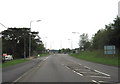
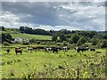
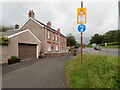
Area Overview for SA31 3NQ
Photos of SA31 3NQ

Area Information
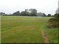
Living in SA31 3NQ offers a quiet residential experience within the Welsh postcode district. This specific cluster covers 37.5 hectares, creating an open, spacious feel that many residents appreciate. The area houses 1,761 people, resulting in a population density of 341 people per square kilometre. This relatively low density ensures that daily life here is not hindered by overcrowding or excessive noise. You will find a community defined by its scale rather than urban grit, making it an appealing choice for those seeking a slower pace. The neighbourhood functions as a self-contained residential unit rather than a commercial hub, prioritising the needs of the homes located within its boundaries. Residents here enjoy a setting where the proximity to larger towns is balanced against the peace of a smaller, more exclusive living environment. The area's structure supports a lifestyle where the immediate surroundings are primarily dedicated to dwelling rather than enterprise. For anyone considering moving to SA31 3NQ, the size of the land and the manageable population count offer a distinct advantage over denser urban zones. It is a place where the local character remains intact, unburdened by the high-pressure dynamics of larger metropolitan centres.
- Area Type
- Postcode
- Area Size
- 37.5 hectares
- Population
- 1761
- Population Density
- 341 people/km²
Homes in SA31 3NQ predominantly consist of houses, which shapes the overall character and structure of the local housing stock. The area is not a mix of varied building types but focuses almost exclusively on detached or semi-detached family dwellings. This concentration of house types aligns with the 75% home ownership rate, suggesting a market heavily weighted towards owner-occupiers rather than tenants or landlords. Buying or selling property here likely involves traditional house exchanges rather than flat sales or commercial developments. The accommodation type data confirms that you will not encounter apartment living within this postcode boundary. Instead, the market revolves around standard residential properties designed for long-term family residence. For buyers looking at this small area and its immediate surroundings, the option of purchasing a standalone house remains the standard. This homogeneity means that maintenance costs and property value trends will follow patterns common to traditional single-family homes rather than multi-unit complexes. The local real estate scene is quiet and reflective, driven by the needs of the established households that make up the majority of the residents.
House Prices in SA31 3NQ
Showing 81 properties
| Address | Type | Beds | Baths | Last Sale Price | Last Sale Date | |
|---|---|---|---|---|---|---|
| 35 Llansteffan Road, Johnstown, Carmarthen, SA31 3NQ | house | - | - | £185,000 | Aug 2018 | |
| 37 Llansteffan Road, Johnstown, Carmarthen, SA31 3NQ | house | - | - | £195,000 | Aug 2012 | |
| Flat E, Rhydygors Cp School, Llansteffan Road, Johnstown, Carmarthen, SA31 3NQ | Flat | - | - | - | - | |
| Flat 4, 38A Llansteffan Road, Johnstown, Carmarthen, SA31 3NQ | Flat | - | - | - | - | |
| 35B Llansteffan Road, Johnstown, Carmarthen, SA31 3NQ | Semi-detached | - | - | - | - | |
| Flat 2, 38A Llansteffan Road, Johnstown, Carmarthen, SA31 3NQ | Flat | - | - | - | - | |
| Flat 3, 38A Llansteffan Road, Johnstown, Carmarthen, SA31 3NQ | Flat | - | - | - | - | |
| 35A Llansteffan Road, Johnstown, Carmarthen, SA31 3NQ | house | - | - | - | - | |
| Flat 1, 38A Llansteffan Road, Johnstown, Carmarthen, SA31 3NQ | Flat | - | - | - | - | |
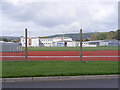
| Tennis 118M From Carmarthen District Leisure Centre, Llansteffan Road 18M From Unnamed Roa, Road To Bron Yr Aur, Johnstown, Carmarthen, SA31 3NQ | Leisure | - | - | - | - |
Energy Efficiency in SA31 3NQ
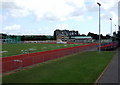
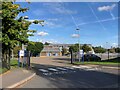
Daily life in SA31 3NQ is supported by a practical range of amenities nearby. Residents have access to 5 retail options within practical reach, including Farmfoods Carmarthen, Spar, and Morrisons Carmarthen. These specific stores provide everyday essentials without forcing you to travel long distances for groceries or household items. For transport, there are 2 railway stations available to you: Carmarthen Railway Station and Ferryside Railway Station. These rail links offer a direct route to connect SA31 3NQ with wider regional networks, facilitating trips to cities or other towns without needing a car. The presence of Morrisons and Spar indicates a supply chain capable of serving local households with fresh produce and basics efficiently. While the area may lack major leisure complexes or international chain outlets, the combination of local supermarkets and train access covers the core needs of a typical week. You can manage your shopping and occasional travel needs comfortably from this postcode. Living in SA31 3NQ means your lifestyle is anchored by these specific, reliable service points.
Amenities
Schools
Families considering SA31 3NQ have access to a specific selection of educational institutions nearby. You will find several options listed as 'other' type schools in the immediate vicinity. The specific schools near SA31 3NQ include Johnstown C.P. School, Queen Elizabeth Cambria, Queen Elizabeth Maridunum, and Ysgol Rhydygors. Additionally, the area contains a Rhydygors Pupil Referral Unit, which serves specific educational needs outside of the standard classroom setting. While the data classifies these institutions as 'other' and does not provide specific Ofsted ratings, their presence indicates a network of educational support within reach of local families. The proximity of multiple schools suggests that parents do not have to travel far to secure schooling for their children. The inclusion of a Pupil Referral Unit highlights that the local education ecosystem caters to a range of learning requirements beyond mainstream schooling. When planning for education in this postcode, you can rely on these named institutions as your primary resources. Living in SA31 3NQ places you within a functional educational radius, even if the detailed performance metrics for each school require separate verification.
| Rank | School | Type | Entry gender | Ages |
|---|
Explore more schools in this area
Go to Schools tabDemographics
The community in SA31 3NQ is defined by stability and a mature population base. The median age stands at 47 years, with the most common age range falling between 30 and 64 years. This demographic profile suggests a neighbourhood dominated by established adults rather than young families or retirees alone. Home ownership is a defining characteristic, with 75% of residents owning their properties outright or with a mortgage. This high ownership rate indicates a settled community where long-term residents form the backbone of the local population. The predominant ethnic group in the area is White, reflecting the traditional makeup of many rural and suburban Welsh settlements. Houses constitute the primary form of accommodation, meaning you will not find tall blocks of flats dominating the skyline. Instead, the streetscape is characterised by individual dwellings spread across the available land. With 75% of homes occupied by their owners, the area likely enjoys strong neighbourhood ties and lower tenant turnover rates. This demographic consistency creates a predictable living environment where the neighbourly relationships tend to be enduring and well-established over time.
Household Size
Accommodation Type
Tenure
Ethnic Group
Religion
Household Composition
Age
Household Deprivation
NS-SEC
Explore more demographic insights in this area
Go to Demographics tabPlanning
Planning Constraints
- Flood RiskPremium
- Ramsar Wetland SitesPremium
- Area of Outstanding Natural BeautyPremium
- Protected Nature ReservePremium
- Protected WoodlandPremium
- Crime RiskPremium