Area Overview for SA31 3GL
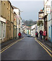
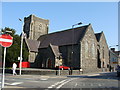
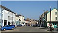
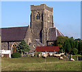
Photos of SA31 3GL


Area Information
Living in SA31 3GL means choosing a specific residential cluster within the wider SA31 postcode area of Wales. This small neighbourhood spans just 3834 square metres, making it a compact community rather than a sprawling suburb. The location is defined by its close-knit nature and its position relative to the town of Carmarthen. You will find that daily life revolves around immediate local needs and a distinct sense of place. The population stands at 1970, creating a tight community where residents often know their neighbours. This density suggests a quiet, domestic environment suitable for those who prefer a smaller living footprint. The area lacks the chaos of large urban centres but offers the convenience of proximity to larger facilities. It serves as a peaceful base for those working in the Carmarthen area or commuting to nearby hubs. The postcode covers a specific cluster of homes, ensuring that every address is within walking or short driving distance of key services. For a buyer, this represents a focused search area with clear boundaries and a defined character. The lack of vast open spaces within the postcode itself means you are surrounded by other dwellings, fostering a village-like atmosphere. This setting appeals to individuals seeking stability and a straightforward property purchase without the complexities of larger developments.
- Area Type
- Postcode
- Area Size
- 3834 m²
- Population
- 1970
- Population Density
- 3938 people/km²
The property market in SA31 3GL is dominated by owner-occupied homes. With 60 per cent home ownership, this area leans heavily toward residents who have purchased their dwellings rather than those renting. The predominant accommodation type is houses, which shapes the architectural character and scale of the streets. You will find that new builds are likely rare given the established nature of the housing stock and the small total area size of 3834 square metres. This suggests a market defined by existing stock where condition and price depend heavily on the individual building's age and upkeep. Buyers entering this market should expect to find traditional houses rather than modern apartments or flats. The concentration of houses fits seamlessly with the older demographic profile, where families and empty nesters often choose detached or semi-detached living. This mix of owned homes implies a stable local economy where residents are less likely to move frequently. For a potential buyer, this means fewer sudden displacements and a consistent community fabric. The property types are uniform, catering primarily to a specific lifestyle and age group. Understanding this helps you evaluate properties based on long-term suitability rather than speculative investment potential common in higher turnover zones.
House Prices in SA31 3GL
Showing 12 properties
| Address | Type | Beds | Baths | Last Sale Price | Last Sale Date | |
|---|---|---|---|---|---|---|
| 6 Pant Y Barcud, Carmarthen, SA31 3GL | Detached | 4 | 2 | £300,000 | Feb 2025 | |
| 3 Pant Y Barcud, Carmarthen, SA31 3GL | Semi-detached | 3 | 1 | £117,800 | Dec 2024 | |
| 12 Pant Y Barcud, Carmarthen, SA31 3GL | house | - | - | £250,000 | Aug 2024 | |
| 7 Pant Y Barcud, Carmarthen, SA31 3GL | house | - | - | £165,000 | Dec 2019 | |
| 9 Pant Y Barcud, Carmarthen, SA31 3GL | house | - | - | £140,000 | Sep 2019 | |
| 4 Pant Y Barcud, Carmarthen, SA31 3GL | Detached | 4 | 3 | £238,000 | Oct 2018 | |
| 8 Pant Y Barcud, Carmarthen, SA31 3GL | house | - | - | £217,500 | Apr 2017 | |
| 2 Pant Y Barcud, Carmarthen, SA31 3GL | house | - | - | £195,000 | May 2013 | |
| 10 Pant Y Barcud, Carmarthen, SA31 3GL | Detached | 3 | 2 | £160,000 | Apr 2013 | |
| 5 Pant Y Barcud, Carmarthen, SA31 3GL | house | - | - | £198,245 | Jul 2012 |
Energy Efficiency in SA31 3GL
Your daily life in SA31 3GL benefits from practical access to essential amenities in Carmarthen. The nearest retail options include Co-op Carmarthen, Tesco Carmarthen, and Lidl Carmarthen, providing a solid range of grocery and daily shopping needs. There are five notable retail facilities within practical reach, ensuring you rarely need to travel far for basics. For commuters or those needing public transit, Carmarthen Railway Station offers rail connections from the area. This single rail hub is the primary link for getting beyond the immediate neighbourhood. Life here is defined by convenience; you can run errands at Co-op or fill the car at Lidl with minimal effort. The proximity of these supermarkets means you are embedded in a functioning daily economy. While the residential area itself is small, the surrounding town provides the services a modern household requires. You do not need to venture far into Carmarthen for routine purchases, which saves time in the busy week. The combination of supermarkets and a railway station creates a balanced lifestyle where isolation is not an issue. This setup supports both a quiet home life and the occasional trip for leisure or larger shopping requirements.
Amenities
Schools
Families living in SA31 3GL have access to specific local educational facilities that serve their community needs. The nearest school listed is St Mary's R.C. Primary School, which operates as a primary institution rooted in the Roman Catholic tradition. This school provides the main educational option for younger children residing in this postcode. While there is no secondary school data provided for immediate proximity, the presence of a primary school indicates that families with school-age children are a known part of the demographic. The categorisation of the school as "other" in the provided details distinguishes its religious character from standard community-run primary establishments. This choice of education often appeals to families wishing for a faith-based environment for their children early in their schooling journey. The proximity of St Mary's R.C. Primary School to the 3834 square metre residential cluster means parents can rely on a locally situated institution. This arrangement reduces travel time and fosters a school community that is intertwined with the wider neighbourhood. For residents considering homes in SA31 3GL, the availability of this specific primary school is a confirmed asset for family planning.
| Rank | School | Type | Entry gender | Ages |
|---|
Explore more schools in this area
Go to Schools tabDemographics
The community in SA31 3GL reflects a mature and settled population. The median age is 47, indicating that the area attracts families and individuals established in mid-life or beyond. Most residents fall into the adult age range of 30 to 64 years, suggesting a workforce that is likely established in their careers rather than transient young professionals. Home ownership stands at 60 per cent, meaning the majority of houses here are bought with a mortgage or paid for outright. This high level of ownership typically correlates with lower turnover and longer-staying residents who have invested in their homes. The predominant accommodation type consists of houses, which aligns with the ownership figures and the age profile. Demographically, the area is predominantly White, consistent with the wider regional pattern in this part of Wales. There is no data suggesting a significant shift toward younger demographics or a high rate of renting. The population density, while appearing high on a square kilometre basis due to the small measured area of 3834 square metres, reflects a concentrated cluster of existing homes rather than overdevelopment. This demographic stability makes the area attractive for buyers looking for a settled neighbourhood where community character is established and unlikely to change rapidly.
Household Size
Accommodation Type
Tenure
Ethnic Group
Religion
Household Composition
Age
Household Deprivation
NS-SEC
Explore more demographic insights in this area
Go to Demographics tabPlanning
Planning Constraints
- Flood RiskPremium
- Ramsar Wetland SitesPremium
- Area of Outstanding Natural BeautyPremium
- Protected Nature ReservePremium
- Protected WoodlandPremium
- Crime RiskPremium