Area Overview for SA20 0YQ
Photos of SA20 0YQ

Area Information
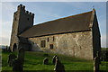
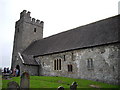
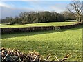
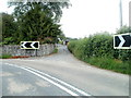
This postcode covers a small residential cluster in Llandovery, Wales. You are looking at an area with a population of 1363 residents spread across a relatively open landscape. The density here is 12 people per square kilometre, which means your next-door neighbour could be many yards away. This low-density setting offers a quiet environment for those who value space and privacy. Living in SA20 0YQ involves managing travel to nearby towns for most daily needs. The area is situated within the SA20 postcode region, providing a specific postcode number for your property. Daily life here revolves around local engagements while relying on nearby hubs for broader services. You will find a community defined by its tight-knit nature and spacious surroundings. There are no large population centres immediately adjacent to this cluster. Instead, the character is defined by the individual homes and the distance between them. This makes SA20 0YQ distinct from busier urban postcodes in Wales.
- Area Type
- Postcode
- Area Size
- Not available
- Population
- 1363
- Population Density
- 12 people/km²
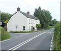
The property market in SA20 0YQ is characterised by traditional housing stock in a rural setting. You will encounter houses as the predominant accommodation type, reflecting the architectural style suited to the Welsh countryside. With a 72 per cent home ownership rate, this is an area where people have stayed for the long term. Very few properties are purchased for short-term renting or speculation. If you are buying a home in SA20 0YQ, expect to look at single-family dwellings rather than apartments or shared housing. The market responds primarily to local demand from the existing community. High ownership levels mean that investor buyers face stiff competition from those who already live here. Properties tend to be owned outright or held as long-term assets rather than flip targets. This stability creates a market that moves slowly and values residence over speculation. You should be prepared for a process that prioritises local fit and long-term suitability for living.
House Prices in SA20 0YQ
No properties found in this postcode.
Energy Efficiency in SA20 0YQ
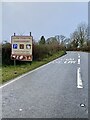
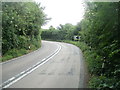
Your daily routine in SA20 0YQ will centre on local accessibility combined with the convenience of nearby major towns. A Co-op Llandovery serves as your primary retail destination for groceries and household essentials. This single notable retailer ensures you can buy routine goods without driving far. For rail travel, you have three nearby stations to choose from, offering flexibility for journeys across the region. Llandovery Railway Station is the most prominent option given its proximity to the major town centre. Residents rely on these three stations for car-free travel needs. The area itself is defined by its homes and the open space between them. You will find that your lifestyle is practical, relying on efficient visits to established shops and trains rather than walking to a high street. This setup works well for those who enjoy the quiet of the village with easy access to town amenities.
Amenities
Schools
Families living in SA20 0YQ have several educational options nearby, though the mix is weighted towards secondary and further education institutions. You will find Ysgol Capel Cynfab listed as a nearby school option. Another significant educational facility close to this cluster is Ysgol Gyfun Pantycelyn. For older students or vocational training, Coleg Elidyr is situated within reach of residents. These institutions are categorised as other schools in standard classifications, often indicating secondary or further education rather than primary settings. Living in SA20 0YQ means your children will likely commute to these specific named establishments for their education. The concentration of these particular schools suggests that primary education may be accessed via further travel or different listings not detailed here. You should confirm specific Ofsted ratings directly with the establishments, as current data lists them by name and type only. The proximity to Ysgol Gyfun Pantycelyn offers a clear option for older children, while Coleg Elidyr provides adult education pathways.
| Rank | School | Type | Entry gender | Ages |
|---|
Explore more schools in this area
Go to Schools tabDemographics
The people you meet in SA20 0YQ reflect a mature community profile. The median age is 47 years, and adults between 30 and 64 years represent the most common age range. This indicates a population with significant life experience and stability. Home ownership stands at 72 per cent, showing a strong tradition of resident investment. Most homes in this area are houses, meaning you will not find the typical flat or block of flats found in cities. The predominant ethnic group is White, aligning with the broader demographic patterns of rural Wales. While specific deprivation data is not included in the current profile, the high home ownership rate suggests financial stability among residents. You should expect a neighbourhood where families and established households form the bulk of the society. The demographic makes this area suitable for older adults and established families rather than young professionals moving in from urban centres. The community feels rooted and settled, with long-term residents forming the core of local life.
Household Size
Accommodation Type
Tenure
Ethnic Group
Religion
Household Composition
Age
Household Deprivation
NS-SEC
Explore more demographic insights in this area
Go to Demographics tabPlanning
Planning Constraints
- Flood RiskPremium
- Ramsar Wetland SitesPremium
- Area of Outstanding Natural BeautyPremium
- Protected Nature ReservePremium
- Protected WoodlandPremium
- Crime RiskPremium