Area Overview for SA19 8SU
Photos of SA19 8SU
Area Information
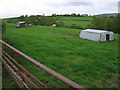
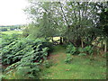
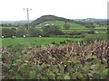
Living in SA19 8SU offers a quiet existence within a small residential cluster located in Wales. This postcode covers just 14.2 hectares, resulting in a highly dispersed community of 1,565 people. You will find a population density of only 10 people per square kilometre, which means the area feels spacious and lacks the crowding found in larger towns. The layout suits those who value a low-key environment over urban convenience. While the small size limits the range of immediate services, the layout ensures a peaceful setting for daily life. This specific postcode serves as a distinct residential pocket rather than a commercial hub or a mixed-use zone. The compact nature of the area creates close physical proximity between homes, yet the low density maintains a sense of individual space. For buyers, this translates to a niche market defined by its rural characteristics within the broader Carmarthenshire landscape. The environment focuses on established domestic settings rather than new developments.
- Area Type
- Postcode
- Area Size
- 14.2 hectares
- Population
- 1565
- Population Density
- 10 people/km²
The property market in SA19 8SU is characterised by a strong preference for residential ownership over renting. With 83% of households in the postcode area owning their dwellings, the over-riding mood is one of stability. The stock consists almost exclusively of houses, which appeals to families and those seeking single-family accommodation. This creates a limited rental market, making it difficult to find tenanted properties compared to the available homes for sale. Buyers looking at homes in SA19 8SU can expect to compete with owner-occupiers who view their properties as long-term assets. The 100% house classification means there are likely no flats or purpose-built apartments within this specific post code. Consequently, searchers with a strict requirement for flat living must look outside these boundaries. The market reflects a settled community where people have rooted themselves for extended periods.
House Prices in SA19 8SU
Showing 1 properties
| Address | Type | Beds | Baths | Last Sale Price | Last Sale Date | |
|---|---|---|---|---|---|---|
| Godregarth, Crugybar To Pumsaint, Crugybar, Llanwrda, SA19 8SU | Detached | - | - | - | - |
Energy Efficiency in SA19 8SU
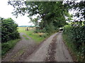
Your daily lifestyle in SA19 8SU revolves around the nearest transport links and local amenities within practical reach. The primary rail option is Llanwrda Railway Station, located just one station away. This connection provides a gateway to the wider rail network for accessing Cardiff or other major cities via Swansea. However, the area offers no local shops, restaurants, or parks listed in the immediate amenity data. Life here relies heavily on the embrace of the national rail service or personal vehicles for daily shopping and leisure. The absence of nearby commercial hubs means you must travel to larger towns for food and entertainment. This proximity to a railway station is the defining feature of your local convenience, replacing urban walkability with planned travel. It offers connectivity but sacrifices the instant gratification of a local high street.
Amenities
Schools
Families living in SA19 8SU are served by two primary educational institutions in the immediate vicinity. You have access to Ysgol Gynradd Llansawel, which serves as the closest primary education option. The second nearby facility is Caio County Primary School, also designated as an 'other' type school. These are the only two schools listed for this location, meaning you do not have immediate access to secondary education within a short commute. The presence of primary schools indicates that families with younger children often reside here before moving to areas with comprehensive schools. Both institutions lack a specified Ofsted rating in the current records, so parents must seek external verification for these specific schools. The limited school choice suggests this area functions as a residential extension for children who will eventually attend schools in larger nearby towns.
| Rank | School | Type | Entry gender | Ages |
|---|
Explore more schools in this area
Go to Schools tabDemographics
The community in SA19 8SU is defined by a mature and stable population structure. Data indicates a median age of 47, reflecting a neighbourhood where adults between 30 and 64 years represent the most common age range. This demographic profile suggests an area attracted to families with children and older professionals rather than young singles or students. Home ownership stands at a significant 83%, creating a predominantly owner-occupied market. This high rate implies long-term residents rather than transient tenants. The primary accommodation type consists of houses, aligning with the preferences of the older adult demographic. Ethnic diversity is currently represented primarily by a White population, consistent with broader regional trends. You can expect a homogeneous community where neighbours likely know each other well through proximity. The age distribution supports a slower pace of life, with fewer young professionals or empty nesters living alone compared to larger urban centres.
Household Size
Accommodation Type
Tenure
Ethnic Group
Religion
Household Composition
Age
Household Deprivation
NS-SEC
Explore more demographic insights in this area
Go to Demographics tabPlanning
Planning Constraints
- Flood RiskPremium
- Ramsar Wetland SitesPremium
- Area of Outstanding Natural BeautyPremium
- Protected Nature ReservePremium
- Protected WoodlandPremium
- Crime RiskPremium