Area Overview for SA18 3UW
Photos of SA18 3UW
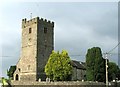
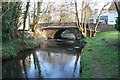
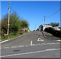
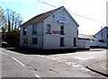
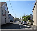
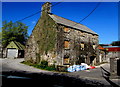
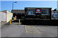
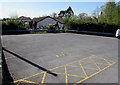
100 photos from this area
Area Information
Key information about the SA18 3UW including its size, population, and administrative classification.
- Area Type
- Postcode
- Area Size
- 2.0 hectares
- Population
- 2087
- Population Density
- 187 people/km²
House Prices in SA18 3UW
34
Properties
£123,083
Average Sold Price
£66,000
Lowest Price
£210,000
Highest Price
Showing 34 properties
| Address | Type | Beds | Baths | Last Sale Price | Last Sale Date | |
|---|---|---|---|---|---|---|
| 18 Ammanford Road, Llandybie, Ammanford, SA18 3UW | Detached | 3 | 2 | £205,000 | Mar 2025 | |
| 35 Ammanford Road, Llandybie, Ammanford, SA18 3UW | Terraced | 4 | 2 | £165,000 | Sep 2024 | |
| 16 Ammanford Road, Llandybie, Ammanford, SA18 3UW | Retail | 5 | 2 | £210,000 | Apr 2023 | |
| 9 Ammanford Road, Llandybie, Ammanford, SA18 3UW | Semi-detached | 1 | 1 | £77,000 | Jul 2022 | |
| 30 Ammanford Road, Llandybie, Ammanford, SA18 3UW | Semi-detached | 4 | 2 | £100,000 | Jun 2020 | |
| 25 Ammanford Road, Llandybie, Ammanford, SA18 3UW | Terraced | 4 | 1 | £100,000 | Jul 2019 | |
| 31 Ammanford Road, Llandybie, Ammanford, SA18 3UW | Flat | - | - | £112,000 | Jul 2019 | |
| 11 Ammanford Road, Llandybie, Ammanford, SA18 3UW | house | - | - | £128,000 | Aug 2018 | |
| 6 Ammanford Road, Llandybie, Ammanford, SA18 3UW | Semi-detached | 3 | 1 | £78,000 | Nov 2015 | |
| 8 Ammanford Road, Llandybie, Ammanford, SA18 3UW | house | - | - | £94,000 | Oct 2014 |
Page 1 of 4
Energy Efficiency in SA18 3UW
Amenities
Schools
| Rank | School | Type | Entry gender | Ages |
|---|
Explore more schools in this area
Go to Schools tabDemographics
Household Size
Two person
most common
Accommodation Type
Houses
most common
Tenure
61
majority
Ethnic Group
White
most common
Religion
N/A
most common
Household Composition
N/A
most common
Age
47
median
Adults (30-64 years)
most common
Household Deprivation
N/A
with no deprivation
NS-SEC
25
in Lower managerial occupations
Explore more demographic insights in this area
Go to Demographics tabPlanning
Planning Constraints
- Flood RiskPremium
- Ramsar Wetland SitesPremium
- Area of Outstanding Natural BeautyPremium
- Protected Nature ReservePremium
- Protected WoodlandPremium
- Crime RiskPremium