Area Overview for SA18 3TD
Photos of SA18 3TD
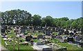
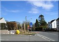
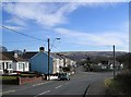
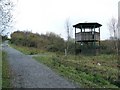
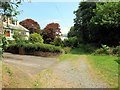
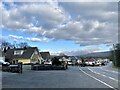
7 photos from this area
Area Information
Key information about the SA18 3TD including its size, population, and administrative classification.
- Area Type
- Postcode
- Area Size
- 31.2 hectares
- Population
- 2306
- Population Density
- 443 people/km²
House Prices in SA18 3TD
43
Properties
£120,041
Average Sold Price
£21,000
Lowest Price
£280,000
Highest Price
Showing 43 properties
| Address | Type | Beds | Baths | Last Sale Price | Last Sale Date | |
|---|---|---|---|---|---|---|
| 55 Parklands Road, Ammanford, SA18 3TD | Bungalow | 3 | 1 | £125,000 | Jun 2024 | |
| 67 Parklands Road, Ammanford, SA18 3TD | house | 3 | 1 | £168,000 | Nov 2022 | |
| 86 Parklands Road, Ammanford, SA18 3TD | Terraced | 3 | 1 | £104,500 | Aug 2022 | |
| 74 Parklands Road, Ammanford, SA18 3TD | house | 3 | 1 | £168,000 | Apr 2022 | |
| 66 Parklands Road, Ammanford, SA18 3TD | Retail | 3 | 1 | £280,000 | Apr 2022 | |
| 84 Parklands Road, Ammanford, SA18 3TD | house | - | - | £159,995 | Jan 2022 | |
| 77 Parklands Road, Ammanford, SA18 3TD | house | - | - | £280,000 | Aug 2021 | |
| 102 Parklands Road, Ammanford, SA18 3TD | Bungalow | 3 | - | £195,000 | Mar 2021 | |
| 65 Parklands Road, Ammanford, SA18 3TD | Semi-detached | 2 | 1 | £105,000 | Oct 2019 | |
| 69 Parklands Road, Ammanford, SA18 3TD | house | - | - | £195,000 | Jul 2019 |
Page 1 of 5
Energy Efficiency in SA18 3TD
Amenities
Schools
| Rank | School | Type | Entry gender | Ages |
|---|
Explore more schools in this area
Go to Schools tabDemographics
Household Size
Two person
most common
Accommodation Type
Houses
most common
Tenure
73
majority
Ethnic Group
White
most common
Religion
N/A
most common
Household Composition
N/A
most common
Age
47
median
Adults (30-64 years)
most common
Household Deprivation
N/A
with no deprivation
NS-SEC
29
in Lower managerial occupations
Explore more demographic insights in this area
Go to Demographics tabPlanning
Planning Constraints
- Flood RiskPremium
- Ramsar Wetland SitesPremium
- Area of Outstanding Natural BeautyPremium
- Protected Nature ReservePremium
- Protected WoodlandPremium
- Crime RiskPremium