Area Overview for SA18 3PD
Photos of SA18 3PD
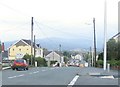
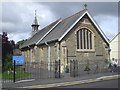
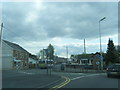
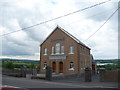
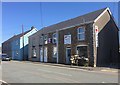
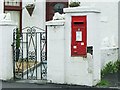
7 photos from this area
Area Information
Key information about the SA18 3PD including its size, population, and administrative classification.
- Area Type
- Postcode
- Area Size
- 4.6 hectares
- Population
- 2412
- Population Density
- 214 people/km²
House Prices in SA18 3PD
65
Properties
£116,336
Average Sold Price
£28,500
Lowest Price
£237,000
Highest Price
Showing 65 properties
| Address | Type | Beds | Baths | Last Sale Price | Last Sale Date | |
|---|---|---|---|---|---|---|
| 164 Teglan Park, Ammanford, SA18 3PD | Detached | 3 | 2 | £195,000 | Dec 2025 | |
| 95 Teglan Park, Ammanford, SA18 3PD | Semi-detached | 3 | 1 | £170,000 | Oct 2025 | |
| 163 Teglan Park, Ammanford, SA18 3PD | Semi-detached | 3 | 1 | £176,000 | Nov 2024 | |
| 92 Teglan Park, Ammanford, SA18 3PD | house | - | - | £177,500 | Aug 2024 | |
| 159 Teglan Park, Ammanford, SA18 3PD | Bungalow | 3 | 2 | £215,000 | Jul 2024 | |
| 104 Teglan Park, Ammanford, SA18 3PD | Detached | 3 | 1 | £237,000 | Jun 2024 | |
| 128 Teglan Park, Ammanford, SA18 3PD | Semi-detached | 3 | 1 | £167,500 | Sep 2023 | |
| 90 Teglan Park, Ammanford, SA18 3PD | Semi-detached | 3 | 1 | £136,000 | Jul 2023 | |
| 89 Teglan Park, Ammanford, SA18 3PD | Semi-detached | 3 | 1 | £146,500 | Apr 2023 | |
| 157 Teglan Park, Ammanford, SA18 3PD | Semi-detached | 3 | 1 | £148,000 | Apr 2023 |
Page 1 of 7
Energy Efficiency in SA18 3PD
Amenities
Schools
| Rank | School | Type | Entry gender | Ages |
|---|
Explore more schools in this area
Go to Schools tabDemographics
Household Size
Two person
most common
Accommodation Type
Houses
most common
Tenure
78
majority
Ethnic Group
White
most common
Religion
N/A
most common
Household Composition
N/A
most common
Age
47
median
Adults (30-64 years)
most common
Household Deprivation
N/A
with no deprivation
NS-SEC
28
in Lower managerial occupations
Explore more demographic insights in this area
Go to Demographics tabPlanning
Planning Constraints
- Flood RiskPremium
- Ramsar Wetland SitesPremium
- Area of Outstanding Natural BeautyPremium
- Protected Nature ReservePremium
- Protected WoodlandPremium
- Crime RiskPremium