Area Overview for SA18 1LE
Photos of SA18 1LE
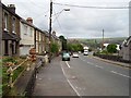

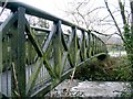
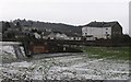


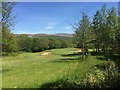
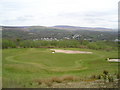
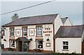


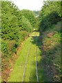
27 photos from this area
Area Information
Key information about the SA18 1LE including its size, population, and administrative classification.
- Area Type
- Postcode
- Area Size
- 1.1 hectares
- Population
- 2049
- Population Density
- 135 people/km²
House Prices in SA18 1LE
16
Properties
£72,417
Average Sold Price
£10,000
Lowest Price
£136,000
Highest Price
Showing 16 properties
| Address | Type | Beds | Baths | Last Sale Price | Last Sale Date | |
|---|---|---|---|---|---|---|
| 212 Cwmamman Road, Garnant, Ammanford, SA18 1LE | Terraced | 3 | 2 | £136,000 | Nov 2022 | |
| 226 Cwmamman Road, Garnant, Ammanford, SA18 1LE | house | - | - | £115,000 | Aug 2022 | |
| 236 Cwmamman Road, Garnant, Ammanford, SA18 1LE | house | - | - | £70,000 | Dec 2021 | |
| 240 Cwmamman Road, Garnant, Ammanford, SA18 1LE | Terraced | 2 | 1 | £59,500 | Nov 2018 | |
| 204A Cwmamman Road, Garnant, Ammanford, SA18 1LE | Terraced | - | - | £112,500 | Jan 2017 | |
| 228 Cwmamman Road, Garnant, Ammanford, SA18 1LE | house | 2 | - | £58,000 | Dec 2013 | |
| 218 Cwmamman Road, Garnant, Ammanford, SA18 1LE | house | - | - | £85,000 | Jul 2007 | |
| 214 Cwmamman Road, Garnant, Ammanford, SA18 1LE | house | 2 | 1 | £60,000 | Jan 2006 | |
| 208 Cwmamman Road, Garnant, Ammanford, SA18 1LE | house | 3 | 1 | £96,000 | Dec 2004 | |
| 210 Cwmamman Road, Garnant, Ammanford, SA18 1LE | Terraced | 3 | 1 | £55,000 | Jul 2004 |
Page 1 of 2
Energy Efficiency in SA18 1LE
Amenities
Schools
| Rank | School | Type | Entry gender | Ages |
|---|
Explore more schools in this area
Go to Schools tabDemographics
Household Size
Two person
most common
Accommodation Type
Houses
most common
Tenure
67
majority
Ethnic Group
White
most common
Religion
N/A
most common
Household Composition
N/A
most common
Age
47
median
Adults (30-64 years)
most common
Household Deprivation
N/A
with no deprivation
NS-SEC
24
in Lower managerial occupations
Explore more demographic insights in this area
Go to Demographics tabPlanning
Planning Constraints
- Flood RiskPremium
- Ramsar Wetland SitesPremium
- Area of Outstanding Natural BeautyPremium
- Protected Nature ReservePremium
- Protected WoodlandPremium
- Crime RiskPremium