Area Overview for SA18 1BA
Photos of SA18 1BA
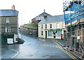


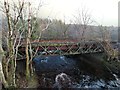
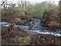
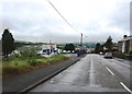


27 photos from this area
Area Information
Key information about the SA18 1BA including its size, population, and administrative classification.
- Area Type
- Postcode
- Area Size
- 2.7 hectares
- Population
- 1403
- Population Density
- 967 people/km²
House Prices in SA18 1BA
42
Properties
£113,612
Average Sold Price
£31,000
Lowest Price
£355,000
Highest Price
Showing 42 properties
| Address | Type | Beds | Baths | Last Sale Price | Last Sale Date | |
|---|---|---|---|---|---|---|
| 29 Llandeilo Road, Upper Brynamman, Ammanford, SA18 1BA | Semi-detached | 3 | 2 | £165,000 | May 2025 | |
| Llys Faen, 25B Llandeilo Road, Upper Brynamman, Ammanford, SA18 1BA | Bungalow | 4 | 2 | £355,000 | Mar 2024 | |
| 18 Llandeilo Road, Upper Brynamman, Ammanford, SA18 1BA | Detached | 3 | - | £118,000 | Dec 2023 | |
| 21 Llandeilo Road, Upper Brynamman, Ammanford, SA18 1BA | Detached | 3 | 1 | £179,950 | Mar 2022 | |
| 6 Llandeilo Road, Upper Brynamman, Ammanford, SA18 1BA | house | - | - | £157,500 | Jan 2021 | |
| 13 Llandeilo Road, Upper Brynamman, Ammanford, SA18 1BA | house | 2 | 1 | £92,500 | Jun 2018 | |
| 17 Llandeilo Road, Upper Brynamman, Ammanford, SA18 1BA | house | 3 | 1 | £76,000 | Oct 2016 | |
| 39 Llandeilo Road, Upper Brynamman, Ammanford, SA18 1BA | Detached | - | - | £210,000 | Jul 2015 | |
| 26 Llandeilo Road, Upper Brynamman, Ammanford, SA18 1BA | Semi-detached | 2 | 1 | £88,500 | May 2015 | |
| 4 Llandeilo Road, Upper Brynamman, Ammanford, SA18 1BA | house | - | - | £81,500 | Jul 2013 |
Page 1 of 5
Energy Efficiency in SA18 1BA
Amenities
Schools
| Rank | School | Type | Entry gender | Ages |
|---|
Explore more schools in this area
Go to Schools tabDemographics
Household Size
One person
most common
Accommodation Type
Houses
most common
Tenure
61
majority
Ethnic Group
White
most common
Religion
N/A
most common
Household Composition
N/A
most common
Age
47
median
Adults (30-64 years)
most common
Household Deprivation
N/A
with no deprivation
NS-SEC
21
in Lower managerial occupations
Explore more demographic insights in this area
Go to Demographics tabPlanning
Planning Constraints
- Flood RiskPremium
- Ramsar Wetland SitesPremium
- Area of Outstanding Natural BeautyPremium
- Protected Nature ReservePremium
- Protected WoodlandPremium
- Crime RiskPremium