Area Overview for SA17 4RY
Photos of SA17 4RY
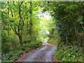
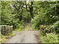
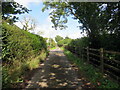
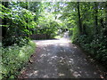
4 photos from this area
Area Information
Key information about the SA17 4RY including its size, population, and administrative classification.
- Area Type
- Postcode
- Area Size
- 32.3 hectares
- Population
- 2239
- Population Density
- 224 people/km²
House Prices in SA17 4RY
6
Properties
£216,800
Average Sold Price
£84,000
Lowest Price
£340,000
Highest Price
Showing 6 properties
| Address | Type | Beds | Baths | Last Sale Price | Last Sale Date | |
|---|---|---|---|---|---|---|
| Drynllwyn Farm, U 2225 From C 2204, Four Roads, Kidwelly, SA17 4RY | house | - | - | £340,000 | Oct 2020 | |
| Y Dderwen Deg, U 2225 From C 2204, Four Roads, Kidwelly, SA17 4RY | house | 3 | - | £250,000 | Jan 2012 | |
| Dolcoed, U 2225 From C 2204, Four Roads, Kidwelly, SA17 4RY | Semi-detached | - | - | £175,000 | Oct 2007 | |
| Drynllwyn Cottage, U 2225 From C 2204, Four Roads, Kidwelly, SA17 4RY | Detached | - | - | £235,000 | May 2007 | |
| Glascoed, U 2225 From C 2204, Four Roads, Kidwelly, SA17 4RY | Detached | - | - | £84,000 | Aug 2000 | |
| Woodfield, U 2225 From C 2204, Four Roads, Kidwelly, SA17 4RY | Semi-detached | - | - | - | - |
Energy Efficiency in SA17 4RY
Amenities
Schools
| Rank | School | Type | Entry gender | Ages |
|---|
Explore more schools in this area
Go to Schools tabDemographics
Household Size
Two person
most common
Accommodation Type
Houses
most common
Tenure
77
majority
Ethnic Group
White
most common
Religion
N/A
most common
Household Composition
N/A
most common
Age
47
median
Adults (30-64 years)
most common
Household Deprivation
N/A
with no deprivation
NS-SEC
30
in Lower managerial occupations
Explore more demographic insights in this area
Go to Demographics tabPlanning
Planning Constraints
- Flood RiskPremium
- Ramsar Wetland SitesPremium
- Area of Outstanding Natural BeautyPremium
- Protected Nature ReservePremium
- Protected WoodlandPremium
- Crime RiskPremium