Area Overview for SA17 4LX
Photos of SA17 4LX
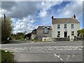
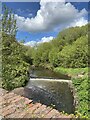
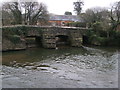
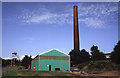


12 photos from this area
Area Information
Key information about the SA17 4LX including its size, population, and administrative classification.
- Area Type
- Postcode
- Area Size
- 4.1 hectares
- Population
- 2133
- Population Density
- 199 people/km²
House Prices in SA17 4LX
16
Properties
£342,490
Average Sold Price
£260,000
Lowest Price
£450,000
Highest Price
Showing 16 properties
| Address | Type | Beds | Baths | Last Sale Price | Last Sale Date | |
|---|---|---|---|---|---|---|
| 3 Parc Felindre, Kidwelly, SA17 4LX | Detached | 4 | 3 | £450,000 | Jul 2025 | |
| 13 Parc Felindre, Kidwelly, SA17 4LX | Detached | 4 | 4 | £370,000 | Oct 2020 | |
| 2 Parc Felindre, Kidwelly, SA17 4LX | Detached | 4 | 3 | £305,000 | Nov 2019 | |
| 8 Parc Felindre, Kidwelly, SA17 4LX | Detached | 4 | 3 | £287,500 | Aug 2019 | |
| 15 Parc Felindre, Kidwelly, SA17 4LX | Detached | 4 | 3 | £285,000 | May 2015 | |
| 14 Parc Felindre, Kidwelly, SA17 4LX | house | 4 | - | £260,000 | Jun 2014 | |
| 9 Parc Felindre, Kidwelly, SA17 4LX | house | - | - | £390,000 | Aug 2011 | |
| 1 Parc Felindre, Kidwelly, SA17 4LX | Detached | 4 | 3 | £280,000 | Nov 2010 | |
| 11 Parc Felindre, Kidwelly, SA17 4LX | Detached | - | - | £335,000 | Apr 2010 | |
| 7 Parc Felindre, Kidwelly, SA17 4LX | house | - | - | £315,000 | Jul 2009 |
Page 1 of 2
Energy Efficiency in SA17 4LX
Amenities
Schools
| Rank | School | Type | Entry gender | Ages |
|---|
Explore more schools in this area
Go to Schools tabDemographics
Household Size
Two person
most common
Accommodation Type
Houses
most common
Tenure
79
majority
Ethnic Group
White
most common
Religion
N/A
most common
Household Composition
N/A
most common
Age
47
median
Adults (30-64 years)
most common
Household Deprivation
N/A
with no deprivation
NS-SEC
31
in Lower managerial occupations
Explore more demographic insights in this area
Go to Demographics tabPlanning
Planning Constraints
- Flood RiskPremium
- Ramsar Wetland SitesPremium
- Area of Outstanding Natural BeautyPremium
- Protected Nature ReservePremium
- Protected WoodlandPremium
- Crime RiskPremium