Area Overview for SA17 4HG
Photos of SA17 4HG

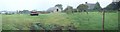
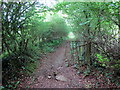
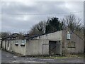
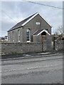
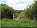
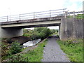

8 photos from this area
Area Information
Key information about the SA17 4HG including its size, population, and administrative classification.
- Area Type
- Postcode
- Area Size
- 2.5 hectares
- Population
- 2239
- Population Density
- 224 people/km²
House Prices in SA17 4HG
38
Properties
£64,278
Average Sold Price
£30,500
Lowest Price
£85,000
Highest Price
Showing 38 properties
| Address | Type | Beds | Baths | Last Sale Price | Last Sale Date | |
|---|---|---|---|---|---|---|
| 42 Maes Y Wern, Carway, Kidwelly, SA17 4HG | house | - | - | £85,000 | Jul 2021 | |
| 71 Maes Y Wern, Carway, Kidwelly, SA17 4HG | Semi-detached | 3 | 1 | £81,000 | Nov 2019 | |
| 65 Maes Y Wern, Carway, Kidwelly, SA17 4HG | house | - | - | £52,500 | Mar 2017 | |
| 76 Maes Y Wern, Carway, Kidwelly, SA17 4HG | house | - | - | £80,000 | Jan 2015 | |
| 48 Maes Y Wern, Carway, Kidwelly, SA17 4HG | Semi-detached | - | - | £71,000 | Jan 2014 | |
| 62 Maes Y Wern, Carway, Kidwelly, SA17 4HG | house | 3 | - | £69,000 | Nov 2011 | |
| 66 Maes Y Wern, Carway, Kidwelly, SA17 4HG | Semi-detached | - | - | £52,500 | Jun 2007 | |
| 57 Maes Y Wern, Carway, Kidwelly, SA17 4HG | Semi-detached | - | - | £57,000 | Nov 2003 | |
| 78 Maes Y Wern, Carway, Kidwelly, SA17 4HG | Semi-detached | - | - | £30,500 | May 1997 | |
| 69 Maes Y Wern, Carway, Kidwelly, SA17 4HG | Semi-detached | 3 | - | - | - |
Page 1 of 4
Energy Efficiency in SA17 4HG
Amenities
Schools
| Rank | School | Type | Entry gender | Ages |
|---|
Explore more schools in this area
Go to Schools tabDemographics
Household Size
Two person
most common
Accommodation Type
Houses
most common
Tenure
77
majority
Ethnic Group
White
most common
Religion
N/A
most common
Household Composition
N/A
most common
Age
47
median
Adults (30-64 years)
most common
Household Deprivation
N/A
with no deprivation
NS-SEC
30
in Lower managerial occupations
Explore more demographic insights in this area
Go to Demographics tabPlanning
Planning Constraints
- Flood RiskPremium
- Ramsar Wetland SitesPremium
- Area of Outstanding Natural BeautyPremium
- Protected Nature ReservePremium
- Protected WoodlandPremium
- Crime RiskPremium