Area Overview for SA16 0AL
Photos of SA16 0AL
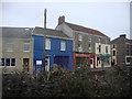
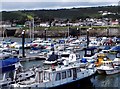
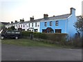
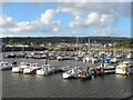
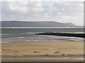
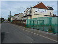
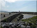
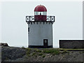
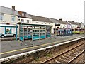
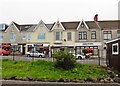
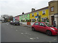
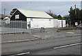
100 photos from this area
Area Information
Key information about the SA16 0AL including its size, population, and administrative classification.
- Area Type
- Postcode
- Area Size
- 4.4 hectares
- Population
- 2022
- Population Density
- 201 people/km²
House Prices in SA16 0AL
39
Properties
£99,784
Average Sold Price
£33,500
Lowest Price
£225,000
Highest Price
Showing 39 properties
| Address | Type | Beds | Baths | Last Sale Price | Last Sale Date | |
|---|---|---|---|---|---|---|
| 36 Heol Elfed, Burry Port, SA16 0AL | Semi-detached | 3 | 1 | £176,500 | Apr 2025 | |
| 20 Heol Elfed, Burry Port, SA16 0AL | Semi-detached | 3 | 1 | £161,000 | Mar 2025 | |
| 8 Heol Elfed, Burry Port, SA16 0AL | Semi-detached | 4 | 1 | £225,000 | May 2024 | |
| 15 Heol Elfed, Burry Port, SA16 0AL | Semi-detached | 2 | 1 | £110,000 | Feb 2024 | |
| 16 Heol Elfed, Burry Port, SA16 0AL | Semi-detached | 2 | 1 | £110,000 | Apr 2023 | |
| 5 Heol Elfed, Burry Port, SA16 0AL | Semi-detached | 2 | 1 | £140,000 | Nov 2022 | |
| 3 Heol Elfed, Burry Port, SA16 0AL | Semi-detached | 3 | 1 | £105,000 | Oct 2022 | |
| 9 Heol Elfed, Burry Port, SA16 0AL | house | - | - | £105,000 | Apr 2022 | |
| 10 Heol Elfed, Burry Port, SA16 0AL | house | - | - | £95,000 | Apr 2020 | |
| 37 Heol Elfed, Burry Port, SA16 0AL | Semi-detached | 2 | - | £90,000 | Jul 2019 |
Page 1 of 4
Energy Efficiency in SA16 0AL
Amenities
Schools
| Rank | School | Type | Entry gender | Ages |
|---|
Explore more schools in this area
Go to Schools tabDemographics
Household Size
Two person
most common
Accommodation Type
Houses
most common
Tenure
62
majority
Ethnic Group
White
most common
Religion
N/A
most common
Household Composition
N/A
most common
Age
47
median
Adults (30-64 years)
most common
Household Deprivation
N/A
with no deprivation
NS-SEC
24
in Lower managerial occupations
Explore more demographic insights in this area
Go to Demographics tabPlanning
Planning Constraints
- Flood RiskPremium
- Ramsar Wetland SitesPremium
- Area of Outstanding Natural BeautyPremium
- Protected Nature ReservePremium
- Protected WoodlandPremium
- Crime RiskPremium