Area Overview for SA14 9PZ
Photos of SA14 9PZ
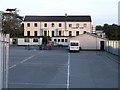
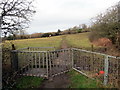
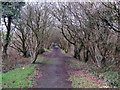
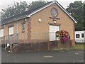
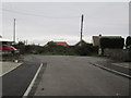
6 photos from this area
Area Information
Key information about the SA14 9PZ including its size, population, and administrative classification.
- Area Type
- Postcode
- Area Size
- 2.1 hectares
- Population
- 2372
- Population Density
- 1775 people/km²
House Prices in SA14 9PZ
83
Properties
£158,712
Average Sold Price
£60,837
Lowest Price
£290,000
Highest Price
Showing 83 properties
| Address | Type | Beds | Baths | Last Sale Price | Last Sale Date | |
|---|---|---|---|---|---|---|
| 42 Maes Y Glo, Llanelli, SA14 9PZ | house | - | - | £76,256 | Aug 2025 | |
| 2 Maes Y Glo, Llanelli, SA14 9PZ | Detached | 4 | 3 | £287,500 | Aug 2025 | |
| 68 Maes Y Glo, Llanelli, SA14 9PZ | Detached | 3 | 2 | £240,000 | Jul 2025 | |
| 72 Maes Y Glo, Llanelli, SA14 9PZ | Terraced | 3 | 1 | £83,500 | Jun 2025 | |
| 32 Maes Y Glo, Llanelli, SA14 9PZ | house | - | - | £200,000 | Jan 2025 | |
| 102 Maes Y Glo, Llanelli, SA14 9PZ | Semi-detached | 3 | 2 | £205,000 | Oct 2024 | |
| 94 Maes Y Glo, Llanelli, SA14 9PZ | house | - | - | £256,000 | Sep 2024 | |
| 4 Maes Y Glo, Llanelli, SA14 9PZ | Detached | 3 | 3 | £240,000 | Aug 2024 | |
| 104 Maes Y Glo, Llanelli, SA14 9PZ | Semi-detached | 3 | 2 | £205,000 | Jul 2024 | |
| 74 Maes Y Glo, Llanelli, SA14 9PZ | Semi-detached | 2 | 1 | £150,000 | Jul 2024 |
Page 1 of 9
Energy Efficiency in SA14 9PZ
Amenities
Schools
| Rank | School | Type | Entry gender | Ages |
|---|
Explore more schools in this area
Go to Schools tabDemographics
Household Size
Family (3-5 people)
most common
Accommodation Type
Houses
most common
Tenure
64
majority
Ethnic Group
White
most common
Religion
N/A
most common
Household Composition
N/A
most common
Age
47
median
Adults (30-64 years)
most common
Household Deprivation
N/A
with no deprivation
NS-SEC
28
in Lower managerial occupations
Explore more demographic insights in this area
Go to Demographics tabPlanning
Planning Constraints
- Flood RiskPremium
- Ramsar Wetland SitesPremium
- Area of Outstanding Natural BeautyPremium
- Protected Nature ReservePremium
- Protected WoodlandPremium
- Crime RiskPremium