Area Overview for SA14 9LR
Photos of SA14 9LR
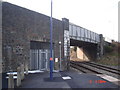
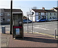
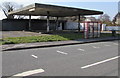
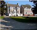
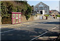
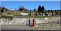

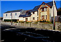
84 photos from this area
Area Information
Key information about the SA14 9LR including its size, population, and administrative classification.
- Area Type
- Postcode
- Area Size
- 7.3 hectares
- Population
- 2402
- Population Density
- 503 people/km²
House Prices in SA14 9LR
40
Properties
£119,273
Average Sold Price
£39,500
Lowest Price
£310,000
Highest Price
Showing 40 properties
| Address | Type | Beds | Baths | Last Sale Price | Last Sale Date | |
|---|---|---|---|---|---|---|
| 22 Cwmfelin Road, Bynea, Llanelli, SA14 9LR | Terraced | 2 | - | £122,500 | Sep 2025 | |
| 48 Cwmfelin Road, Bynea, Llanelli, SA14 9LR | Semi-detached | - | - | £155,000 | Dec 2024 | |
| 46 Cwmfelin Road, Bynea, Llanelli, SA14 9LR | Detached | 4 | 2 | £165,000 | Jan 2024 | |
| 58 Cwmfelin Road, Bynea, Llanelli, SA14 9LR | Terraced | 3 | 1 | £145,000 | Oct 2021 | |
| 28 Cwmfelin Road, Bynea, Llanelli, SA14 9LR | house | 2 | - | £107,000 | Oct 2020 | |
| 78 Cwmfelin Road, Bynea, Llanelli, SA14 9LR | Detached | 5 | 4 | £280,000 | May 2020 | |
| 38 Cwmfelin Road, Bynea, Llanelli, SA14 9LR | Terraced | 3 | 1 | £104,500 | Mar 2019 | |
| 76 Cwmfelin Road, Bynea, Llanelli, SA14 9LR | Semi-detached | 4 | - | £310,000 | Sep 2018 | |
| 80 Cwmfelin Road, Bynea, Llanelli, SA14 9LR | Detached | 5 | - | £205,000 | Sep 2016 | |
| 56 Cwmfelin Road, Bynea, Llanelli, SA14 9LR | house | 2 | - | £87,500 | Sep 2016 |
Page 1 of 4
Energy Efficiency in SA14 9LR
Amenities
Schools
| Rank | School | Type | Entry gender | Ages |
|---|
Explore more schools in this area
Go to Schools tabDemographics
Household Size
Two person
most common
Accommodation Type
Houses
most common
Tenure
83
majority
Ethnic Group
White
most common
Religion
N/A
most common
Household Composition
N/A
most common
Age
47
median
Adults (30-64 years)
most common
Household Deprivation
N/A
with no deprivation
NS-SEC
35
in Lower managerial occupations
Explore more demographic insights in this area
Go to Demographics tabPlanning
Planning Constraints
- Flood RiskPremium
- Ramsar Wetland SitesPremium
- Area of Outstanding Natural BeautyPremium
- Protected Nature ReservePremium
- Protected WoodlandPremium
- Crime RiskPremium