Area Overview for SA14 7PN
Photos of SA14 7PN
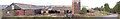
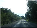

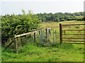
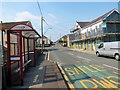
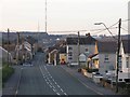
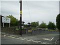
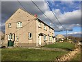
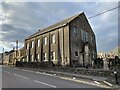
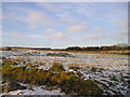
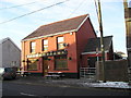

12 photos from this area
Area Information
Key information about the SA14 7PN including its size, population, and administrative classification.
- Area Type
- Postcode
- Area Size
- 9.8 hectares
- Population
- 1363
- Population Density
- 375 people/km²
House Prices in SA14 7PN
59
Properties
£133,242
Average Sold Price
£30,000
Lowest Price
£383,000
Highest Price
Showing 59 properties
| Address | Type | Beds | Baths | Last Sale Price | Last Sale Date | |
|---|---|---|---|---|---|---|
| 70 Waterloo Road, Penygroes, Llanelli, SA14 7PN | Semi-detached | 4 | 2 | £145,000 | Jul 2024 | |
| 76 Waterloo Road, Penygroes, Llanelli, SA14 7PN | Semi-detached | 3 | 1 | £150,000 | Nov 2023 | |
| 71 Waterloo Road, Penygroes, Llanelli, SA14 7PN | Semi-detached | 4 | 1 | £161,000 | Oct 2023 | |
| 91 Waterloo Road, Penygroes, Llanelli, SA14 7PN | Semi-detached | 2 | 1 | £160,000 | Nov 2022 | |
| 92 Waterloo Road, Penygroes, Llanelli, SA14 7PN | Semi-detached | 3 | 1 | £146,000 | May 2022 | |
| 88 Waterloo Road, Penygroes, Llanelli, SA14 7PN | Detached | 4 | 1 | £212,000 | Dec 2021 | |
| 49 Waterloo Road, Penygroes, Llanelli, SA14 7PN | house | - | - | £138,000 | Oct 2021 | |
| 112 Waterloo Road, Penygroes, Llanelli, SA14 7PN | house | - | - | £285,000 | Oct 2020 | |
| 110 Waterloo Road, Penygroes, Llanelli, SA14 7PN | house | - | - | £285,000 | Mar 2020 | |
| 108 Waterloo Road, Penygroes, Llanelli, SA14 7PN | house | - | - | £279,500 | Oct 2019 |
Page 1 of 6
Energy Efficiency in SA14 7PN
Amenities
Schools
| Rank | School | Type | Entry gender | Ages |
|---|
Explore more schools in this area
Go to Schools tabDemographics
Household Size
Two person
most common
Accommodation Type
Houses
most common
Tenure
77
majority
Ethnic Group
White
most common
Religion
N/A
most common
Household Composition
N/A
most common
Age
47
median
Adults (30-64 years)
most common
Household Deprivation
N/A
with no deprivation
NS-SEC
27
in Lower managerial occupations
Explore more demographic insights in this area
Go to Demographics tabPlanning
Planning Constraints
- Flood RiskPremium
- Ramsar Wetland SitesPremium
- Area of Outstanding Natural BeautyPremium
- Protected Nature ReservePremium
- Protected WoodlandPremium
- Crime RiskPremium