Area Overview for SA14 7DL
Photos of SA14 7DL
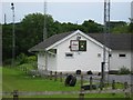
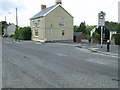

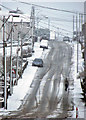
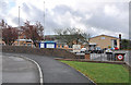
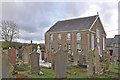

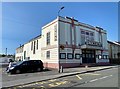

9 photos from this area
Area Information
Key information about the SA14 7DL including its size, population, and administrative classification.
- Area Type
- Postcode
- Area Size
- 4.3 hectares
- Population
- 2479
- Population Density
- 331 people/km²
House Prices in SA14 7DL
42
Properties
£121,481
Average Sold Price
£2,500
Lowest Price
£230,000
Highest Price
Showing 42 properties
| Address | Type | Beds | Baths | Last Sale Price | Last Sale Date | |
|---|---|---|---|---|---|---|
| 50 Heol Y Parc, Cefneithin, Llanelli, SA14 7DL | house | 3 | 2 | £222,500 | Mar 2025 | |
| 109 Heol Y Parc, Cefneithin, Llanelli, SA14 7DL | Semi-detached | 2 | 1 | £215,000 | Oct 2024 | |
| 113 Heol Y Parc, Cefneithin, Llanelli, SA14 7DL | Semi-detached | 3 | 2 | £215,000 | Oct 2022 | |
| 73 Heol Y Parc, Cefneithin, Llanelli, SA14 7DL | house | - | - | £230,000 | May 2021 | |
| 59 Heol Y Parc, Cefneithin, Llanelli, SA14 7DL | Semi-detached | 2 | 1 | £90,000 | Mar 2021 | |
| 81 Heol Y Parc, Cefneithin, Llanelli, SA14 7DL | Semi-detached | 2 | 1 | £129,500 | Nov 2019 | |
| 75 Heol Y Parc, Cefneithin, Llanelli, SA14 7DL | Detached | 2 | 1 | £165,000 | Nov 2018 | |
| 56 Heol Y Parc, Cefneithin, Llanelli, SA14 7DL | Semi-detached | 3 | 1 | £80,000 | Aug 2018 | |
| 52 Heol Y Parc, Cefneithin, Llanelli, SA14 7DL | house | - | - | £2,500 | Nov 2016 | |
| 79 Heol Y Parc, Cefneithin, Llanelli, SA14 7DL | Semi-detached | 2 | 1 | £97,500 | Oct 2015 |
Page 1 of 5
Energy Efficiency in SA14 7DL
Amenities
Schools
| Rank | School | Type | Entry gender | Ages |
|---|
Explore more schools in this area
Go to Schools tabDemographics
Household Size
Two person
most common
Accommodation Type
Houses
most common
Tenure
75
majority
Ethnic Group
White
most common
Religion
N/A
most common
Household Composition
N/A
most common
Age
47
median
Adults (30-64 years)
most common
Household Deprivation
N/A
with no deprivation
NS-SEC
32
in Lower managerial occupations
Explore more demographic insights in this area
Go to Demographics tabPlanning
Planning Constraints
- Flood RiskPremium
- Ramsar Wetland SitesPremium
- Area of Outstanding Natural BeautyPremium
- Protected Nature ReservePremium
- Protected WoodlandPremium
- Crime RiskPremium