Area Overview for SA14 6AQ
Photos of SA14 6AQ
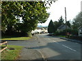
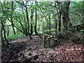
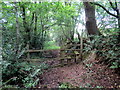
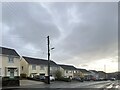
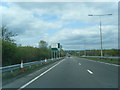
6 photos from this area
Area Information
Key information about the SA14 6AQ including its size, population, and administrative classification.
- Area Type
- Postcode
- Area Size
- 9052 m²
- Population
- 1957
- Population Density
- 419 people/km²
House Prices in SA14 6AQ
15
Properties
£142,620
Average Sold Price
£100,000
Lowest Price
£189,950
Highest Price
Showing 15 properties
| Address | Type | Beds | Baths | Last Sale Price | Last Sale Date | |
|---|---|---|---|---|---|---|
| 1 Clos Gwili, Cwmgwili, Llanelli, SA14 6AQ | Semi-detached | 3 | 1 | £185,000 | Jun 2025 | |
| 5 Clos Gwili, Cwmgwili, Llanelli, SA14 6AQ | Semi-detached | 3 | 2 | £182,000 | Jul 2024 | |
| 2 Clos Gwili, Cwmgwili, Llanelli, SA14 6AQ | Semi-detached | 3 | 2 | £189,950 | Dec 2022 | |
| 6 Clos Gwili, Cwmgwili, Llanelli, SA14 6AQ | Semi-detached | 3 | 2 | £179,995 | Jun 2022 | |
| 11 Clos Gwili, Cwmgwili, Llanelli, SA14 6AQ | Semi-detached | 3 | 1 | £127,000 | Mar 2019 | |
| 15 Clos Gwili, Cwmgwili, Llanelli, SA14 6AQ | Terraced | 3 | 1 | £113,500 | Sep 2018 | |
| 7 Clos Gwili, Cwmgwili, Llanelli, SA14 6AQ | Detached | 3 | 1 | £130,000 | May 2017 | |
| 14 Clos Gwili, Cwmgwili, Llanelli, SA14 6AQ | Terraced | 3 | 1 | £100,000 | Mar 2014 | |
| 13 Clos Gwili, Cwmgwili, Llanelli, SA14 6AQ | Terraced | 3 | 1 | £120,000 | Jan 2014 | |
| 12 Clos Gwili, Cwmgwili, Llanelli, SA14 6AQ | Semi-detached | 3 | 2 | £122,000 | Jun 2013 |
Page 1 of 2
Energy Efficiency in SA14 6AQ
Amenities
Schools
| Rank | School | Type | Entry gender | Ages |
|---|
Explore more schools in this area
Go to Schools tabDemographics
Household Size
Two person
most common
Accommodation Type
Houses
most common
Tenure
72
majority
Ethnic Group
White
most common
Religion
N/A
most common
Household Composition
N/A
most common
Age
47
median
Adults (30-64 years)
most common
Household Deprivation
N/A
with no deprivation
NS-SEC
28
in Lower managerial occupations
Explore more demographic insights in this area
Go to Demographics tabPlanning
Planning Constraints
- Flood RiskPremium
- Ramsar Wetland SitesPremium
- Area of Outstanding Natural BeautyPremium
- Protected Nature ReservePremium
- Protected WoodlandPremium
- Crime RiskPremium