Area Overview for Pwll
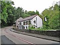
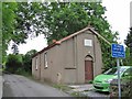
Photos of Pwll

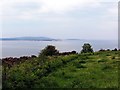
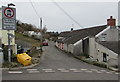
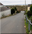
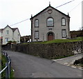

Area Information
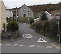
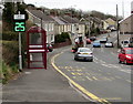
Pwll, a built-up area in Wales, spans 62.1 hectares and is home to a population characterised by a median age of 70. This suggests a community that may lean towards older residents, though the exact demographic breakdown is not fully detailed. The area is compact, with a mix of housing types that cater to a range of needs. Daily life in Pwll is shaped by its proximity to key amenities, including retail hubs and rail connections. For instance, residents can access Co-op Sandy, Asda Llanelli, and Aldi Pen-y, all within practical reach. Rail services are also well-established, with stations such as Llanelli and Pembrey & Burry Port providing links to broader networks. While Pwll does not have a high-profile tourist draw, its accessibility and local services make it a viable option for those seeking a quieter, established community. The area’s broadband quality is excellent, scoring 94 out of 100, ensuring reliable internet for both work and leisure. However, mobile coverage is slightly lower, at 80, which may affect connectivity for those reliant on cellular data. Overall, Pwll offers a blend of practicality and convenience, though its appeal may depend on individual priorities such as age demographics and transport needs.
- Area Type
- Built Up Area 250
- Area Size
- 62.1 hectares
- Population
- Not available
- Population Density
- Not available
Living in Pwll provides access to a range of nearby amenities that support daily life. Retail options include Co-op Sandy, Asda Llanelli, and Aldi Pen-y, offering a mix of grocery and general shopping needs. These stores are conveniently located, reducing the need for long trips to larger centres. The rail network further enhances accessibility, with stations like Llanelli and Pembrey & Burry Port enabling travel to nearby towns for additional services or social activities. While the area does not have detailed information on parks or leisure facilities, the presence of multiple rail stations and retail outlets suggests a focus on practicality over expansive recreational spaces. For residents, this means a lifestyle that prioritises convenience and connectivity over sprawling green spaces. The mix of shops and transport links ensures that daily errands and travel are manageable, though those seeking more extensive leisure options may need to look beyond Pwll itself.
Amenities
Schools
The only school explicitly listed near Pwll is Pwll C.P. Mixed School, which serves both primary and secondary education. The school’s type is categorised as "other," though its Ofsted rating is not provided in the data. This suggests that while the school exists, its quality and performance are not quantified here. For families, the presence of a mixed school indicates a facility that accommodates both younger and older students, potentially reducing the need for multiple educational institutions. However, the absence of additional schools in the area means that parents may need to consider commuting options for higher education or specialist needs. The limited school data reflects a broader gap in the area’s educational infrastructure, which could be a concern for families prioritising a range of educational choices.
| Rank | A + A* % | School | Type | Entry gender | Ages |
|---|---|---|---|---|---|
| 1 | N/A | Pwll C.P. Mixed School | other | N/A | N/A |
Explore more schools in this area
Go to Schools tabDemographics
The population of Pwll has a median age of 70, indicating a community skewed towards older residents. The most common age range is listed as "Age: Total," which suggests that data is aggregated without breakdowns by specific age groups. Home ownership in the area is high, with 80% of residents owning their homes. This reflects a stable housing market where property ownership is the norm rather than the exception. Accommodation types and household compositions are not detailed in the data, but the high home ownership rate implies a predominance of owner-occupied properties. The predominant ethnic group and religious affiliations are not specified, though the data notes "total" for both categories, meaning no single group dominates. This could suggest a relatively homogeneous population, though further details are not available. The lack of specific deprivation data means that quality-of-life factors such as access to services or economic hardship are not quantified. However, the presence of nearby schools and amenities suggests that basic needs are met, even if the community’s social fabric remains understudied.
Household Size
Accommodation Type
Tenure
Ethnic Group
Religion
Household Composition
Age
Household Deprivation
NS-SEC
Explore more demographic insights in this area
Go to Demographics tabPlanning
Planning Constraints
- Crime RiskLocked