Area Overview for Ferryside
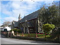
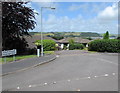
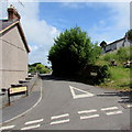
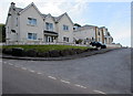
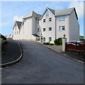
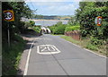
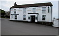
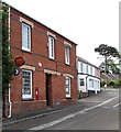
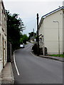
Photos of Ferryside


Area Information
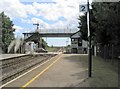
Ferryside, a built-up area in Wales, spans 41.9 hectares and offers a compact, well-defined living environment. With a median age of 70, the community here is predominantly mature, reflecting a demographic profile that prioritises stability and established living. The area’s home ownership rate of 83% underscores a strong presence of long-term residents, many of whom may have lived in the area for decades. Daily life in Ferryside is shaped by its proximity to key amenities, including two railway stations—Ferryside and Kidwelly—which provide easy access to nearby towns. Retail options within reach include Co-op Kidwelly, Spar, and Morrisons Carmarthen, ensuring residents have access to essential shopping. The area’s small size and centralised amenities create a convenient, low-maintenance lifestyle, ideal for those seeking a quiet, well-serviced community without the sprawl of larger towns. Ferryside’s character is defined by its balance of practicality and accessibility, making it a viable choice for buyers looking for a settled, mature environment.
- Area Type
- Built Up Area 250
- Area Size
- 41.9 hectares
- Population
- Not available
- Population Density
- Not available
Ferryside’s lifestyle is shaped by its proximity to essential retail and transport hubs. Within practical reach are Co-op Kidwelly, Spar, and Morrisons Carmarthen, offering a range of shopping and dining options. These outlets provide convenience for daily needs, from groceries to household supplies. The area’s two railway stations—Ferryside and Kidwelly—enhance mobility, connecting residents to broader networks for work, leisure, or travel. While the data does not specify parks or leisure facilities, the presence of retail and transport amenities suggests a focus on practicality over expansive recreational spaces. For those prioritising accessibility and ease of access to services, Ferryside’s lifestyle offers a balance of convenience and simplicity, with minimal need for long commutes or extensive travel for basic needs.
Amenities
Schools
The nearest school to Ferryside is Ferryside VCP, which is categorised as an 'other' type. No Ofsted rating is provided in the data, so its academic performance or quality cannot be assessed from this information alone. The absence of additional schools in the vicinity means families may need to look further afield for alternative educational options. For those prioritising proximity to schools, Ferryside’s single listed institution may necessitate a broader search for secondary or primary education. The type of school listed as 'other' could indicate a specialist or non-traditional educational setting, though without further details, its specific focus remains unclear. Families considering Ferryside should investigate local school options beyond the immediate area to ensure alignment with their children’s needs.
| Rank | A + A* % | School | Type | Entry gender | Ages |
|---|---|---|---|---|---|
| 1 | N/A | Ferryside VCP | other | N/A | N/A |
Explore more schools in this area
Go to Schools tabDemographics
The population of Ferryside is predominantly aged 70, with the most common age range encompassing all demographics. This suggests a community where older residents form a significant proportion, potentially influencing local services and social dynamics. Home ownership is high, with 83% of households owning their properties, indicating a stable, long-term resident base. The data does not specify household composition or accommodation types, but the overall home ownership rate implies a lower reliance on rental properties. The absence of detailed figures on diversity or religious composition means the area’s cultural and social makeup remains less defined in the data. For those considering Ferryside, the demographic profile suggests a community focused on continuity, with limited turnover and a strong emphasis on private residence. This may appeal to buyers seeking a place with a settled, mature atmosphere, though it also means the area may lack the vibrancy of more diverse or younger populations.
Household Size
Accommodation Type
Tenure
Ethnic Group
Religion
Household Composition
Age
Household Deprivation
NS-SEC
Explore more demographic insights in this area
Go to Demographics tabPlanning
Planning Constraints
- Crime RiskLocked