Area Overview for St. Clears Community
Photos of St. Clears Community


Area Information
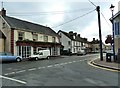
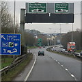
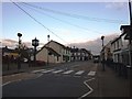
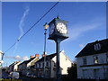
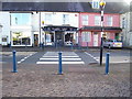
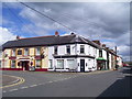
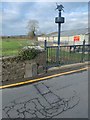
St. Clears Community stretches across 30.8 square kilometres in Wales, functioning as a distinct civil parish with a quiet rural character. The area is defined by its peaceful setting and established community structure rather than high-density development. You will find a stark contrast between a rapidly modernising digital experience and an traditional settlement pace, reflecting a lifestyle that has remained relatively unchanged for decades. The median age of residents sits at 70 years, indicating a population dominated by older generations seeking a slower, more settled life away from the city rush. This demographic profile shapes the daily rhythm of the parish, where services and social activities cater primarily to mature residents. Living in St. Clears Community means accepting a landscape managed carefully around conservation zones, including protected nature reserves and specifically safeguarded woodland. These planning constraints ensure the natural environment remains intact, but they also limit major construction projects within the parish boundaries. You are looking at a location where the built environment coexists tightly with designated green spaces, creating a very specific type of countryside living. The low population density and high home ownership rates suggest a neighbourhood where residents have strong roots and long-term ties to the land. Daily life here revolves around local amenities and the surrounding countryside, with very little industry or large-scale commerce disrupting the tranquility of the 30.8 square kilometre footprint.
- Area Type
- Parish
- Area Size
- 30.8 km²
- Population
- Not available
- Population Density
- Not available
Demographics
The demographic landscape of St. Clears Community is heavily skewed towards older residents, with a median age of exactly 70 years. This age profile reflects a retirement destination or a retirement village style living arrangement rather than a area attracting young families or students. While the data does not break down specific age brackets beyond the total count, the high median age directly influences local demand for healthcare services and social clubs suited to seniors. You will encounter very few households with young children or working-age professionals under 50. Home ownership stands at 71% within St. Clears Community, indicating that the vast majority of residents purchased their properties or inherited them and have stayed for the long term. This high level of tenure creates a stable neighbourhood where neighbours often know each other after decades of residence. The household composition data confirms this stability, showing a total count that aligns with a mature population structure. Accommodation types generally follow this owner-occupied lead, featuring traditional bungalows and larger family homes rather than modern high-rise blocks. Although specific ethnicity and religion figures are aggregated in the total count, the settlement remains largely homogeneous in its cultural composition. There is no indication of significant recent migration or multicultural enclaves developing within the parish. The high concentration of older, owner-occupied homes means the local economy relies heavily on pension income and state benefits rather than a dynamic salary-driven workforce.
Household Size
Accommodation Type
Tenure
Ethnic Group
Religion
Household Composition
Age
Household Deprivation
NS-SEC
Explore more demographic insights in this area
Go to Demographics tabPlanning
Planning Constraints
- Flood RiskPremium
- Ramsar Wetland SitesPremium
- Area of Outstanding Natural BeautyPremium
- Protected Nature ReservePremium
- Protected WoodlandPremium
- Crime RiskPremium