Area Overview for Llangunnor Community
Photos of Llangunnor Community
Area Information
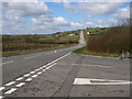
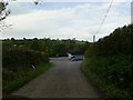
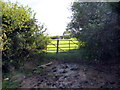
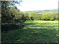
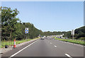
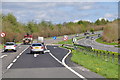
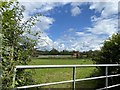
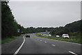
Llangunnor Community stands as a distinct civil parish within Wales, covering an expanse of 23.5 square kilometres. You will find a population of 1,128 residents spread across this area, resulting in a relatively sparse population density of 48 people per square kilometre. This low density suggests a quiet, rural setting rather than a densely built-up urban environment. Living in Llangunnor Community offers a sense of space and open air that defines daily life for those who call this parish home. The area operates outside the major waterways or designated conservation zones that constrain development in other parts of Britain. Specifically, there are no Ramsar wetland sites or Areas of Outstanding Natural Beauty covering the land, which simplifies local planning constraints. However, you must be aware that the parish contains protected nature reserves and protected woodland. These designations mean that future development in these specific patches is restricted. For buyers looking for space without the strict controls of high-value conservation areas, Llangunnor Community presents a balanced option. The community feels like a traditional Welsh parish where the layout supports a slower pace of life. Residents benefit from a layout that separates housing from the most sensitive ecological features while maintaining open land availability.
- Area Type
- Parish
- Area Size
- 23.5 km²
- Population
- 1128
- Population Density
- 48 people/km²
Demographics
The demographic profile of Llangunnor Community reveals a settlement dominated by older residents. The median age in the parish is 70 years old, indicating a significant proportion of the population consists of retirees. This age profile extends to the total age range, suggesting that the community is not growing with young families or students. Home ownership is the primary form of tenure, with 86% of homes owned outright or with a mortgage. This high rate of ownership implies stability within the neighbourhood, as residents are likely long-term rather than transient tenants. You should expect to deal with owners who have deep roots in the parish when purchasing or renting properties. The data does not specify the majority age range breakdown beyond the total, nor does it detail specific religious or ethnic compositions. This lack of granular demographic data means you cannot predict specific cultural subgroups within the 1,128 residents. Nevertheless, the high ownership figure and older median age create a predictable social environment. Your neighbours will likely be individuals who have lived in their homes for decades. This tenure structure also suggests lower turnover rates, fostering a consistent community character over time.
Household Size
Accommodation Type
Tenure
Ethnic Group
Religion
Household Composition
Age
Household Deprivation
NS-SEC
Explore more demographic insights in this area
Go to Demographics tabPlanning
Planning Constraints
- Flood RiskPremium
- Ramsar Wetland SitesPremium
- Area of Outstanding Natural BeautyPremium
- Protected Nature ReservePremium
- Protected WoodlandPremium
- Crime RiskPremium