Area Overview for Llandovery Community
Photos of Llandovery Community
Area Information
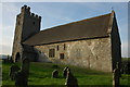
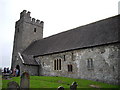
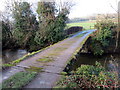
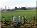
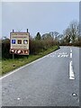
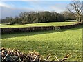
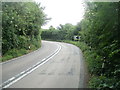
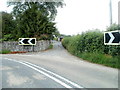
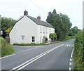
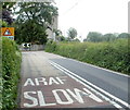
Living in Llandovery Community offers a distinctly rural experience within the historic market town of Llandovery in Carmarthenshire, Wales. This civil parish covers an area of 19.1 square kilometres, providing ample space for open land alongside residential developments. You will find a location that balances proximity to town amenities with the quiet of the surrounding countryside. The community sits comfortably within Pembrokeshire, preserving a traditional Welsh character that defines daily life here. Residents enjoy a setting defined by its rural nature and historical significance rather than rapid urbanisation. The small size of the parish means distances are short, allowing for easy access to local shops, green spaces, and community events without the congestion typical of larger cities. Those considering homes in Llandovery Community should appreciate the tranquility of the area, where nature provides a constant backdrop to everyday routines. The location is established and stable, attracting individuals and families who value a slower pace while remaining connected to local services. For anyone looking to settle down, Llandovery Community presents a manageable environment where the layout supports a relaxed lifestyle. The parish boundaries encompass a mix of residential zones and open land, ensuring that the natural landscape remains a central feature of life here. You can expect a supportive neighbourhood where local identity is strong and the connection to the wider region is seamless. This area remains a solid choice for those seeking grounded living without the pressures associated with high-density urban centres. The specific character of the parish makes it an enduring option for long-term residence.
- Area Type
- Parish
- Area Size
- 19.1 km²
- Population
- Not available
- Population Density
- Not available
Demographics
The demographic profile of Llandovery Community reflects a mature population with a median age of 70. This older-than-average group shapes the rhythm of the neighbourhood, influencing local service needs and community activities. The data indicates that Age: Total is the most common age range category, reinforcing the presence of senior residents throughout the parish. You are joining a community where a significant portion of the population has moved past active career phases, favouring retirement homes or smaller properties suited to later life. Home ownership stands at 69%, creating a stable environment where many residents hold their property outright or with less than forty years left on their mortgage. This high ownership rate suggests deep roots within the area, as families tend to stay for extended periods rather than moving frequently for work. The household composition and accommodation type data both reflect a total picture of established living arrangements, indicating a settled society rather than a transient rental market. Variety in ethnicity and religious affiliation exists within the parish, though specific breakdowns are not detailed in current records. The diversity present adds subtle layers to the local culture without dominating the overall character of the settlement. You can expect a community focused on shared local traditions where long-term residents form strong bonds. The 69% ownership figure means you are likely purchasing a home that has been in the hands of previous generations, contributing to the area's sense of continuity. This stability offers reassurance alongside the dynamic interactions found in any active neighbourhood.
Household Size
Accommodation Type
Tenure
Ethnic Group
Religion
Household Composition
Age
Household Deprivation
NS-SEC
Explore more demographic insights in this area
Go to Demographics tabPlanning
Planning Constraints
- Flood RiskPremium
- Ramsar Wetland SitesPremium
- Area of Outstanding Natural BeautyPremium
- Protected Nature ReservePremium
- Protected WoodlandPremium
- Crime RiskPremium