Area Overview for Laugharne Township Community
Photos of Laugharne Township Community
Area Information
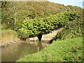
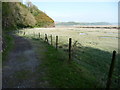
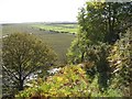
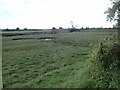
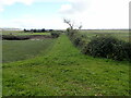
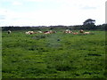
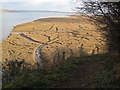
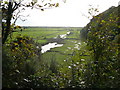
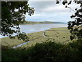
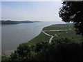
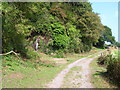
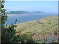
Living in Laugharne Township Community offers a distinct experience within the wider parish. This civil parish covers an expansive 36.6 km², providing ample space compared to more densely populated urban centres. You will find yourself in a rural Welsh setting where the landscape and history shape daily life. The area is characterised by a strong sense of locality, typical of many smaller parishes in Wales. Daily routines revolve around local amenities and community interactions rather than the fast pace of city living. The scale of the parish suggests a environment where neighbours know each other and local services are embedded within the fabric of the community. When considering homes in Laugharne Township Community, you are entering a space defined by its geography and established character. The layout supports a slower lifestyle, ideal for those who prefer quiet residential streets over manicured suburbs. You should expect a community where tradition meets the practicalities of modern rural living. This area is not a high-pressure zone but a place where residents settle for the long term. The vast size of the parish means you have access to diverse micro-locations within the same administrative boundary. It is a place defined by its roots in Wales and its integration into the broader local authority structure.
- Area Type
- Parish
- Area Size
- 36.6 km²
- Population
- Not available
- Population Density
- Not available
Demographics
The community within Laugharne Township Community reflects an established residential pattern. Data shows that median age is 70, indicating a population skewed significantly towards older residents. The most common age range is recorded as Total, confirming no single bracket dominates beyond this median figure. Home ownership stands at 68 per cent, meaning nearly seven out of ten households own their property outright or with a mortgage. This high level of ownership suggests stability and long-term commitment to the area. Household composition and accommodation type data are available as total categories, outlining the broad makeup of the residents. Ethnic diversity and religious affiliation are recorded as total figures, representing the aggregate population without specific breakdowns. The high ownership rate contrasts with younger, transient areas where rental markets thrive. Residents here likely stay in their homes for decades, building deep ties to the neighbourhood. This demographic profile impacts local businesses, which cater mainly to mature households with specific needs. Quality of life revolves around this older demographic, with services and social structures potentially adapted for their preferences. The area is not targeted at young families or students but serves as a retirement or legacy community. Understanding the age profile helps you gauge whether the local shops, transport links, and social events match your lifestyle requirements. Living here means engaging with a community that has settled and grown old together.
Household Size
Accommodation Type
Tenure
Ethnic Group
Religion
Household Composition
Age
Household Deprivation
NS-SEC
Explore more demographic insights in this area
Go to Demographics tabPlanning
Planning Constraints
- Flood RiskPremium
- Ramsar Wetland SitesPremium
- Area of Outstanding Natural BeautyPremium
- Protected Nature ReservePremium
- Protected WoodlandPremium
- Crime RiskPremium