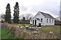
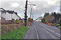
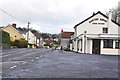
Area Overview for Gorslas Community
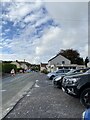
Photos of Gorslas Community
Area Information
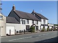
Gorslas Community is a defined unitary electoral division covering 16.5 km² in Wales. The area functions as a distinct residential zone with specific characteristics that shape daily life for its residents. You will find that the community is tightly knit, defined by clear boundaries and a consistent population profile. Living in Gorslas Community means settling into an environment where the total area size provides a sense of space without the isolation often found in more remote Welsh locations. The locality is characterised by a stable demographic, which creates a predictable rhythm for neighbourhood interaction. When you look at homes in Gorslas Community, you are entering an established setting where the physical layout supports a quiet residential lifestyle. The area does not offer the diversity of large urban centres, but it provides a defined space for those seeking a settled pace of life. Your experience will be shaped by the fact that you are within a 16.5 km² zone that operates independently as an electoral division. This structure often implies local governance focused specifically on the needs of people residing in Gorslas Community. The distinctness of the area ensures that local services and planning decisions address the specific reality of this particular piece of land.
- Area Type
- Parish
- Area Size
- 16.5 km²
- Population
- Not available
- Population Density
- Not available
Demographics
The people living in Gorslas Community display a very clear age profile, with a median age of 70 years. This figure indicates that the area is predominantly comprised of older residents who have likely lived here for many decades. When you consider the community in Gorslas Community, you are looking at a population almost certainly focused on retirement or post-retirement life. The higher age range suggests that families with young children are not a primary component of the local demographic. Home ownership stands at a remarkable 79%, a specific figure that highlights the long-term commitment of the current residents to their homes. This high rate of ownership typically correlates with the older age profile, as individuals often downsize or remain in properties they have owned for extended periods. You will not encounter significant transitory populations in this location. The household composition and accommodation types reflect this stability, suggesting that the stock in Gorslas Community serves established, older families rather than younger, mobile cohorts. Diversity data regarding ethnicity and religion are not available in the provided records, so you cannot make assumptions about cultural demographics beyond the clear age and ownership indicators.
Household Size
Accommodation Type
Tenure
Ethnic Group
Religion
Household Composition
Age
Household Deprivation
NS-SEC
Explore more demographic insights in this area
Go to Demographics tabPlanning
Planning Constraints
- Flood RiskPremium
- Ramsar Wetland SitesPremium
- Area of Outstanding Natural BeautyPremium
- Protected Nature ReservePremium
- Protected WoodlandPremium
- Crime RiskPremium