Area Overview for Whitchurch Community
Photos of Whitchurch Community
Area Information
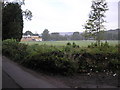
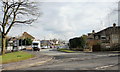
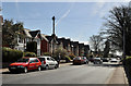
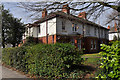
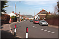
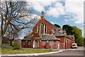
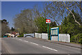
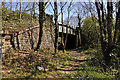
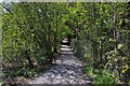
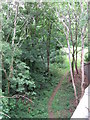
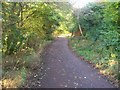
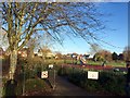
Whitchurch Community is a historic civil parish situated in the northwest of Cardiff, Wales. You are looking at a location that covers exactly 4.4 square kilometres of land. The name derives from St Mary's chapel, which serves as a significant landmark within this area. This parish encompasses land that has been central to Cardiff's development for nearly a thousand years. It sits within the bend of the River Taff where medieval mills once operated. The area contains a population of 3,056 residents. Daily life here is shaped by a deep history that dates back to the early 12th century. The settlement includes the Philog hamlet, recorded in 1811 as a collection of scattered cottages. You will see historic religious buildings such as the church foundation laid in 1894 and the Ararat Baptist Chapel built in 1851. The landscape includes protected woodland and views towards the nearby ruins of Castell Coch. This mix of historical significance and residential life creates a distinct character. The region functions as a residential hub with strong local roots. St Mary's Church on Penlline Road stands as a focal point for the neighbourhood. The area combines its agricultural past with a modern residential present. You live in a place where the past is physically present in the streets and buildings. The population density stands at 695 people per square kilometre, reflecting a settled community rather than spread-out development. Living in Whitchurch Community means inhabiting a space with documented centuries of local governance and change.
- Area Type
- Parish
- Area Size
- 4.4 km²
- Population
- 3056
- Population Density
- 695 people/km²
Demographics
The community in Whitchurch Community reflects a mature population structure. The median age for residents is 70 years old. This indicates an area where older adults form a significant portion of the population. The data shows that the total age group represents the primary demographic focus for this parish. Home ownership is the dominant housing tenure model. A full 77% of households in Whitchurch Community own their property outright or with a mortgage. This high rate of ownership suggests a settled community where residents have long-term stakes in their local streets. The household composition data represents the total household count for the area. Accommodation types also reflect the total stock available within the parish boundaries. You are entering a neighbourhood characterised by stability and established tenure. The demographics point to a village-like atmosphere where long-term residents predominate. The high ownership figure removes much of the transient nature typically found in larger urban zones. Residents here likely have deep ties to the local parishes and church institutions. The population of 3,056 people across 4.4 km² supports a close-knit social environment. This age profile and ownership pattern define the cultural tone of the parish. Families and retirees share space in an environment where property values have historically supported local investment. The demographic picture is one of quiet stability with a clear focus on residential permanence.
Household Size
Accommodation Type
Tenure
Ethnic Group
Religion
Household Composition
Age
Household Deprivation
NS-SEC
Explore more demographic insights in this area
Go to Demographics tabPlanning
Planning Constraints
- Flood RiskPremium
- Ramsar Wetland SitesPremium
- Area of Outstanding Natural BeautyPremium
- Protected Nature ReservePremium
- Protected WoodlandPremium
- Crime RiskPremium