Area Overview for Tremorfa Community
Photos of Tremorfa Community
Area Information
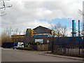
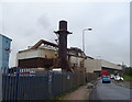
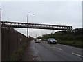
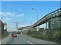
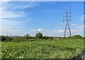
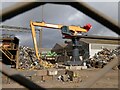
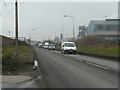
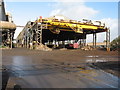
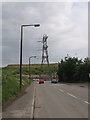
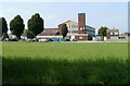
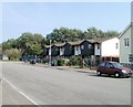
Tremorfa Community sits within the city of Cardiff, Wales, and functions as a distinct civil parish. This district covers an area of 4.4 km² and forms part of the Splott ward. The name translates to 'town plus coastal marsh' in Welsh, reflecting its geographical history near Cardiff Docks. You will find the settlement connects to Pengam Green via Tremorfa Park, with Pengam Green officially classed within the Tremorfa boundaries. Since becoming one of four new communities in Cardiff in 2016, the area has carved out its own identity while maintaining close ties to neighbouring Splott. Currently, 4,839 residents call this parish home. The population density stands at 1,092 people per square kilometre, creating a relatively compact urban environment. Living in Tremorfa offers access to notable local landmarks such as the historic Tremorfa Park and the legacy of former industrial sites like the East Moors Steelworks. While the area carries a rich industrial past involving GKN and the Rover Car Company, daily life for you today revolves around this dense, historically significant neighbourhood. The distinction from previous parish structures underscores its importance as a defined local community within the wider urban fabric of the city.
- Area Type
- Parish
- Area Size
- 4.4 km²
- Population
- 4839
- Population Density
- 1092 people/km²
Demographics
Moredach in the parish of Tremorfa has an old-age community. The median age for residents is 70 years, indicating a population significantly skewed towards elderly living arrangements. Analysis of the household composition shows a specific residential pattern, though the most common age range data available simply confirms the total demographic profile. This high average age suggests that you are likely moving into an area populated by retirees or long-term residents. Within Tremorfa Community, home ownership accounts for 43 per cent of households. Consequently, just over a third of the population currently owns their property outright or with a mortgage. This implies a substantial proportion of homes are rented. The total figures for accommodation type data remain broad across the parish, without breaking down specific building styles in the provided information. You should expect a mix of urban housing suited to these demographic needs. The ethnic diversity and religious breakdown of the parish are recorded as total figures in the available datasets, pointing to a recorded community. Understanding that the median age is 70 provides essential context for your quality of life assessment in Tremorfa. Services and amenities often cater to these older demographics. The high population density of 1,092 people per square kilometre further supports a service-oriented local culture. When considering homes in Tremorfa, the lack of young families in the primary data suggests a quiet, settled atmosphere rather than a bustling commuter town.
Household Size
Accommodation Type
Tenure
Ethnic Group
Religion
Household Composition
Age
Household Deprivation
NS-SEC
Explore more demographic insights in this area
Go to Demographics tabPlanning
Planning Constraints
- Flood RiskPremium
- Ramsar Wetland SitesPremium
- Area of Outstanding Natural BeautyPremium
- Protected Nature ReservePremium
- Protected WoodlandPremium
- Crime RiskPremium