Area Overview for Roath Community
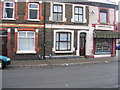
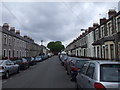
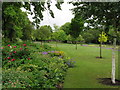
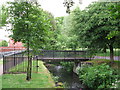
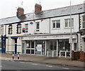
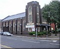
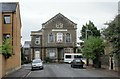
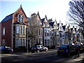
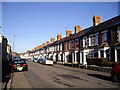
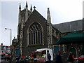
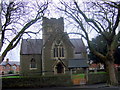
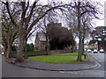
Photos of Roath Community
Area Information
Living in Roath Community offers a distinct experience within the civil parish located north-east of Cardiff city centre. This small but densely populated area covers just 1.6 square kilometres while accommodating a population of 6,862 residents. You will find a population density of 4,217 people per square kilometre, which indicates a tightly knit urban environment rather than a spread-out rural village. The area's name derives from the Welsh word *Rhâth*, hinting at ancient earthworks that may have once served as a fortified settlement for the Silures tribe. Despite its modern urban density, the landscape bears the legacy of a medieval agricultural settlement established as a home farm for Cardiff Castle in the late 11th century. Daily life here reflects a history dating back to the Norman lord Robert Fitzhamon, yet it has evolved rapidly since the late 19th century. The community now exists within the larger city fabric, blending historical significance with contemporary living standards. As a civil parish, Roath retains a specific local identity while functioning as a vibrant district. Recent development models suggest a shift from its origins as a husbandry estate to a fully integrated part of the Welsh capital. You are stepping into a location where history meets the present, situated in an area that has undergone significant transformation since the 1880s. The community's compact nature means you will likely know your neighbours instantly, fostering a close connection to the specific streets and landmarks of this parish.
- Area Type
- Parish
- Area Size
- 1.6 km²
- Population
- 6862
- Population Density
- 4217 people/km²
Demographics
The community profile within Roath reveals a demographic that skews significantly towards older residents. The median age for the population stands at exactly 70 years, which marks one of the oldest age distributions typical for a Welsh urban district. This high median age suggests that the area is popular with retirees or long-term residents who have stayed well past standard retirement years. While specific data on the most common age range is recorded only as a total catalogue entry, the overarching picture points to a mature demographic rather than a bustling family hub. Home ownership presents a mixed picture for those considering buying a property in this parish. Only 35% of households here own their homes outright. This figure implies that a substantial majority, roughly 65%, reside in rented accommodation or homes they are actively purchasing but do not yet own. Such a ratio often characterises areas undergoing transition or those favoured by young professionals and investors rather than established owner-occupiers. Regarding accommodation types and household composition, the available records list these metrics without specific numerical breakdowns, meaning the exact split between single-person homes, families, and shared flats remains generalised in the provided records. Ethnic diversity and religious affiliation are recorded in the total datasets for Roath Community, yet the data does not supply specific percentages for the predominant ethnic group or religious breakdown. Consequently, you must rely on the known urban context of Cardiff to understand the diversity. The absence of granular breakdowns for these categories prevents a detailed statistical portrait, but the rapid suburbanisation seen from c.1880 likely brought varied influences to the area then as now.
Household Size
Accommodation Type
Tenure
Ethnic Group
Religion
Household Composition
Age
Household Deprivation
NS-SEC
Explore more demographic insights in this area
Go to Demographics tabPlanning
Planning Constraints
- Flood RiskPremium
- Ramsar Wetland SitesPremium
- Area of Outstanding Natural BeautyPremium
- Protected Nature ReservePremium
- Protected WoodlandPremium
- Crime RiskPremium