Area Overview for Llanedeyrn Community
Photos of Llanedeyrn Community

Area Information
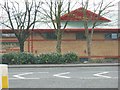
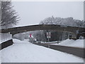
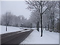
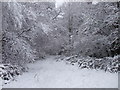
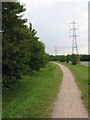
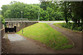
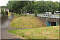
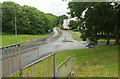
Living in Llanedeyrn Community means residing within a civil parish that spans 1.8 km² in eastern Cardiff. This former rural parish now functions as a distinct suburban district, situated approximately 3.5 miles from the city centre near the River Rhymney boundary with Monmouthshire. You will find modern housing estates divided by the M4-A48 link road, with a historic church, pub, and affordable housing located to the west. The area retains its historical roots named after St Edeyrn, a 6th-century saint, while serving a population of 1,833 residents. Daily life is influenced by proximity to Cyncoed and the surrounding suburbs of Pentwyn. The community sits at grid reference ST215815 under the CF23 postcode, encompassing areas like CF2 6UX. While the landscape is defined by 1960s-1970s council housing estates, the neighbourhood benefits from well-planned infrastructure. A working-class feel permeates the district, supported by local amenities such as the Maelfa Shopping Centre and Coed y Nant park. This park features a lake and playing field, offering grounds that were formerly ancient woodland. The area is accessed via the M4 motorway, which supports local car showrooms and hotels. You are essentially living in a residential zone where history meets post-war urban development.
- Area Type
- Parish
- Area Size
- 1.8 km²
- Population
- 1833
- Population Density
- 1013 people/km²
Demographics
The people living in Llanedeyrn Community represent a distinct demographic profile with a median age of 70 years. This figure indicates that the population consists predominantly of older residents compared to the national average. One hundred and eighty-three three individuals call this parish home within a total household composition that includes various family structures. Sixty-eight percent of the population has been living in Cardiff for more than one year, while three percent have moved to Llanedeyrn within the last year. Home ownership levels in the area stand at 56 percent, meaning more than half of the properties are privately owned rather than rented. The remaining 44 percent of homes are owner-occupied or rented, creating a mixed market environment. The population density reaches 1,013 people per km², reflecting the compact nature of this 1.8 km² parish. Historical records note that the area was once a farming community owned by the Kemys-Tynte family before urbanisation expanded significantly after 1960. Today, the estates include prefabricated, terraced houses and flats. The workforce is largely drawn from local services and employment in nearby Pentwyn.
Household Size
Accommodation Type
Tenure
Ethnic Group
Religion
Household Composition
Age
Household Deprivation
NS-SEC
Explore more demographic insights in this area
Go to Demographics tabPlanning
Planning Constraints
- Flood RiskPremium
- Ramsar Wetland SitesPremium
- Area of Outstanding Natural BeautyPremium
- Protected Nature ReservePremium
- Protected WoodlandPremium
- Crime RiskPremium