Area Overview for Lisvane Community
Photos of Lisvane Community
Area Information
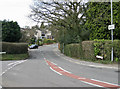
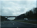
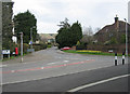
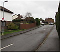
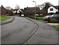
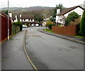
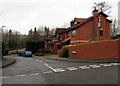
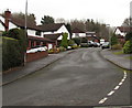
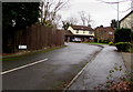
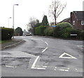
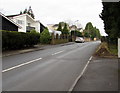
Living in Lisvane Community means settling into a civil parish that has evolved into an affluent suburb of Cardiff. This area covers 7.8 km² and sits within the Kibbor hundred of Glamorgan. It is centred around the CF14 0AZ postcode area, specifically near the coordinates 51.536652, -3.177927. The community transitioned from an almost purely rural parish in 1911 to a suburb by 1974 under the Local Government Act 1972. Today, the population stands at approximately 1,756 residents. This figure represents significant growth compared to historical records showing only 248 people in 1891 and 340 in 1911. The modern identity of Lisvane Community blends its ancient heritage as a parish with the contemporary reality of a residential neighbourhood close to the M4 motorway. Residents enjoy access to notable landmarks such as Lisvane Reservoir and Cefn Onn Park. The area provides a distinct shift in lifestyle for those who previously helped build the region or now seek a calmer existence near the city. Your daily life here is defined by a history stretching back to the 18th century, including the establishment of Dderwen Deg Meeting House and the later construction of the reservoir between 1864 and 1865.
- Area Type
- Parish
- Area Size
- 7.8 km²
- Population
- Not available
- Population Density
- Not available
Demographics
The demographic profile of Lisvane Community reveals an older population centre within Cardiff. The median age is 70, meaning half of the residents are older than this figure. This high age suggests a quiet environment with few young families raising children nearby. The most common age grouping listed as "Age: Total" confirms that the entire population skews toward older demographics. Household composition and accommodation type data remain unsegmented, but the high senior population implies smaller households or couples living in their own homes. Ownership rates are exceptionally high at 91%, indicating that residents successfully purchased their properties rather than renting. This statistic confirms the area is dominated by owner-occupied homes. The predominant ethnic group and religious affiliations are recorded generally, reflecting a shift from the ancient parish roots to a modern residential zone. Deprivation data is not highlighted as a primary factor in this affluent district. The 1,756 current population provides a tight-knit feel, contrasting sharply with the rapid expansion seen between 1891 and 1974. If you prioritise older neighbours and lower population density, this demographic structure ensures your daily interactions will reflect these settled patterns.
Household Size
Accommodation Type
Tenure
Ethnic Group
Religion
Household Composition
Age
Household Deprivation
NS-SEC
Explore more demographic insights in this area
Go to Demographics tabPlanning
Planning Constraints
- Flood RiskPremium
- Ramsar Wetland SitesPremium
- Area of Outstanding Natural BeautyPremium
- Protected Nature ReservePremium
- Protected WoodlandPremium
- Crime RiskPremium