Area Overview for CF5 5XA
Photos of CF5 5XA

Area Information
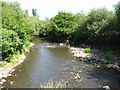
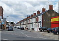
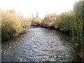
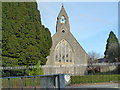
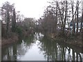
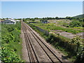
CF5 5XA is a compact residential postcode in western Cardiff, Wales, encompassing a small cluster of homes with a population of 1,394. Covering just 1.6 hectares, it is densely populated, with 89,706 people per square kilometre, reflecting its suburban character. Historically, the area was rural, becoming part of Cardiff in 1922. It sits near the former Ely Racecourse, now Trelai Park, and retains traces of its past, including Iron Age hillforts and a Roman villa. The area is part of the Caerau and Ely wards, which together have around 26,000 residents. Daily life here is shaped by its proximity to transport links, including rail and ferry services, and a mix of local amenities. While the community faces social and economic challenges, its heritage, such as the CAER Heritage Project, offers cultural depth. For homebuyers, CF5 5XA offers a compact, historically rich environment with practical connectivity, though its small size means limited housing options.
- Area Type
- Postcode
- Area Size
- 1.6 hectares
- Population
- 1394
- Population Density
- 2352 people/km²
CF5 5XA is primarily an owner-occupied area, with 67% of homes owned by residents rather than rented. The accommodation type is predominantly houses, reflecting a suburban rather than a high-density housing stock. Given the area’s small size—just 1.6 hectares—there are limited housing options, which may make the property market competitive. The concentration of houses suggests a preference for family homes, though the compact nature of the postcode means buyers must consider proximity to the wider Caerau and Ely areas for more extensive choices. The high population density, combined with the focus on owner-occupation, indicates a stable market where properties are likely to retain value. However, the limited supply of homes could lead to higher prices or longer search times for buyers.
House Prices in CF5 5XA
No properties found in this postcode.
Energy Efficiency in CF5 5XA
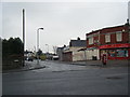
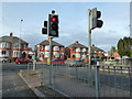
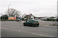
Residents of CF5 5XA have access to a range of nearby amenities, including five retail outlets such as Spar, Co-op Cardiff, and Farmfoods Ely, ensuring daily shopping needs are met. The area’s transport links connect to parks like Trelai Park and Caerau Wood, offering green spaces for recreation. The CAER Heritage Project provides a community hub, reflecting the area’s historical significance. While the postcode itself is small, its proximity to rail, ferry, and bus services expands access to Cardiff’s broader amenities. The mix of retail, transport, and green spaces supports a convenient lifestyle, though the compact nature of CF5 5XA means residents must travel slightly further for more extensive facilities. This balance of local convenience and regional connectivity shapes the area’s practical appeal.
Amenities
Schools
The nearest school to CF5 5XA is Millbank Primary School, which is categorised as an ‘other’ type in the data. No Ofsted ratings or performance metrics are provided, so its educational quality remains unspecified. The absence of additional schools in the area means families may need to look beyond CF5 5XA for secondary education or specialist provisions. While the primary school is accessible, the limited number of schools in the immediate vicinity could affect convenience for parents, particularly those reliant on local facilities. The single school suggests a modest educational infrastructure, which may require families to consider commuting to nearby areas for broader schooling options.
| Rank | School | Type | Entry gender | Ages |
|---|
Explore more schools in this area
Go to Schools tabDemographics
The population of CF5 5XA is predominantly adults aged 30–64, with a median age of 47. Home ownership is high at 67%, and the area is characterised by houses rather than flats. The majority of residents identify as White, reflecting the broader demographic trends in the region. The high population density of 89,706 people per square kilometre suggests a compact, closely knit community. While the data does not specify deprivation levels, the age profile indicates a mature population, which may influence local services and amenities. The absence of detailed diversity statistics means the community’s social composition is less defined beyond the predominant ethnic group. This demographic structure could impact the demand for housing and local facilities, with a focus on stability and long-term residency.
Household Size
Accommodation Type
Tenure
Ethnic Group
Religion
Household Composition
Age
Household Deprivation
NS-SEC
Explore more demographic insights in this area
Go to Demographics tabPlanning
Planning Constraints
- Flood RiskPremium
- Ramsar Wetland SitesPremium
- Area of Outstanding Natural BeautyPremium
- Protected Nature ReservePremium
- Protected WoodlandPremium
- Crime RiskPremium