Area Overview for CF5 4TL
Photos of CF5 4TL
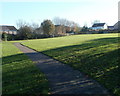
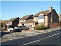
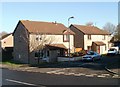
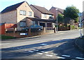
20 photos from this area
Area Information
Key information about the CF5 4TL including its size, population, and administrative classification.
- Area Type
- Postcode
- Area Size
- 1.2 hectares
- Population
- 1266
- Population Density
- 3069 people/km²
House Prices in CF5 4TL
43
Properties
£115,687
Average Sold Price
£36,578
Lowest Price
£250,000
Highest Price
Showing 43 properties
| Address | Type | Beds | Baths | Last Sale Price | Last Sale Date | |
|---|---|---|---|---|---|---|
| 40 Llanover Road, Ely, Cardiff, CF5 4TL | Semi-detached | 3 | 2 | £250,000 | Aug 2024 | |
| 83 Llanover Road, Ely, Cardiff, CF5 4TL | house | - | - | £225,000 | Mar 2021 | |
| 75 Llanover Road, Ely, Cardiff, CF5 4TL | house | - | - | £192,000 | Dec 2016 | |
| 103 Llanover Road, Ely, Cardiff, CF5 4TL | Flat | 1 | 1 | £72,000 | May 2016 | |
| 111 Llanover Road, Ely, Cardiff, CF5 4TL | Flat | - | - | £72,000 | Dec 2015 | |
| 117 Llanover Road, Ely, Cardiff, CF5 4TL | Flat | 1 | - | £73,000 | Dec 2013 | |
| 46 Llanover Road, Ely, Cardiff, CF5 4TL | house | - | - | £155,000 | Aug 2010 | |
| 36 Llanover Road, Ely, Cardiff, CF5 4TL | Semi-detached | 3 | 1 | £159,950 | Jul 2009 | |
| 89 Llanover Road, Ely, Cardiff, CF5 4TL | Terraced | - | - | £81,950 | Dec 2001 | |
| 87 Llanover Road, Ely, Cardiff, CF5 4TL | Terraced | - | - | £69,450 | May 2000 |
Page 1 of 5
Energy Efficiency in CF5 4TL
Amenities
Schools
| Rank | School | Type | Entry gender | Ages |
|---|
Explore more schools in this area
Go to Schools tabDemographics
Household Size
Two person
most common
Accommodation Type
Houses
most common
Tenure
86
majority
Ethnic Group
White
most common
Religion
N/A
most common
Household Composition
N/A
most common
Age
47
median
Adults (30-64 years)
most common
Household Deprivation
N/A
with no deprivation
NS-SEC
33
in Lower managerial occupations
Explore more demographic insights in this area
Go to Demographics tabPlanning
Planning Constraints
- Flood RiskPremium
- Ramsar Wetland SitesPremium
- Area of Outstanding Natural BeautyPremium
- Protected Nature ReservePremium
- Protected WoodlandPremium
- Crime RiskPremium